Your experience, the route, altitude, season, current trekking regulations, and how comfortable you are handling unexpected situations all matter.
So the better question is not simply, “Is Nepal safe for solo female trekkers?”
It is: “Which trek is right for me, and how independently should I do it?”
Can You Trek Alone in Nepal as a Woman?
You can travel to Nepal alone and join a trek, travel with a guide, or, where regulations allow, trek independently.
These are three different things.
Solo travel means you are travelling through Nepal by yourself.
Solo trekking with a guide means you are the only client in your trekking group, but a guide accompanies you.
Independent trekking means you manage the route, accommodation, navigation, permits, and problems yourself.
For a first-time visitor, the second option can be a useful middle ground. You still have the freedom of travelling alone without having to deal with every trekking decision by yourself.
The rules also vary between trekking regions. Routes such as Manaslu and Upper Mustang have different permit and guide requirements from less restricted trekking areas, so do not assume that a rule that applies to one trek automatically applies to another.
Which Nepal Treks Are Suitable for Solo Female Travelers?
The route you choose can make a bigger difference to your experience than whether you are travelling alone.
Trek
Suitable for a first solo trek?
What to consider
Poon Hill
Yes
Shorter route with regular accommodation and plenty of trekkers
Mardi Himal
Yes, with preparation
Steeper sections and higher altitude than Poon Hill
Langtang Valley
Yes, with preparation
More remote than the busiest Annapurna routes
Annapurna Base Camp
Yes, with preparation
Longer days and increasing altitude
Annapurna Circuit
Better with trekking experience
Long route, high altitude and Thorong La
Everest Base Camp
Better with preparation
Altitude is the main concern
Manaslu Circuit
Not ideal for independent beginners
Restricted area and more remote sections
Upper Mustang
Not ideal for independent beginners
Restricted-area regulations and additional logistics
For a first solo trek, Poon Hill is one of the easier places to start. You can also consider Mardi Himal or Annapurna Base Camp if you are physically prepared and understand the demands of trekking at altitude.
Remote and restricted routes are a different proposition. The challenge is not simply navigation. You also have to deal with permits, accommodation, weather, transportation, altitude and fewer services along parts of the route.
What Are the Main Safety Concerns?
Nepal is generally welcoming to female travelers, but trekking has risks that have little to do with gender.
Altitude
Altitude is one of the biggest concerns on high Himalayan treks.
You can be fit, experienced, and completely healthy and still develop altitude sickness. This is why a sensible itinerary matters more than trying to walk as quickly as possible.
If you develop symptoms such as headache, nausea, unusual fatigue, dizziness or difficulty sleeping after gaining altitude, do not simply push through them.
On high-altitude routes, your guide or trekking team should be prepared to recognize altitude-related problems and decide when you need to stop ascending or descend.
Rain can make lower trails slippery and increase the possibility of landslides or difficult river crossings. At higher elevations, snow, wind and poor visibility can become more important.
This is one reason a flexible itinerary is valuable. A fixed schedule should not be more important than trail conditions.
Getting lost or taking the wrong trail
Popular routes are generally easier to follow than remote trails, but that does not mean you should rely entirely on your phone.
Download maps before leaving, keep your phone charged, and know the name of your destination each day.
If you are unsure about a junction, ask a local guide, lodge owner or other trekkers rather than taking an unmarked shortcut.
Accommodation and personal belongings
Teahouses are a normal part of trekking in Nepal, but standards vary between routes and individual lodges.
Keep your passport, permits, money, phone and other important belongings with you rather than putting them in luggage carried separately.
You do not need to treat every person you meet as a potential threat. Basic awareness is enough. If someone makes you uncomfortable, create distance and seek help from your guide, lodge staff or other trekkers.
What About Trekking Alone During the Off-Season?
Season matters.
Spring and autumn are generally the busiest trekking periods, which means more people are on the major trails and weather conditions are often more suitable for trekking.
Winter can work well for lower-altitude routes, while high passes and high-altitude trails require more preparation because of cold and snow.
Monsoon brings rain, muddy trails, leeches and possible landslides to many trekking areas. Some rain-shadow regions, including Upper Mustang, are a different case, but they also have their own regulations and logistical considerations.
If this is your first solo trek, choosing a season with more predictable trail conditions can make the experience considerably easier.
What Should You Do Before Your Trek?
You do not need to overprepare, but you should know what you are getting into.
Before leaving Kathmandu or Pokhara:
Check the current permit and guide requirements for your specific route.
Share your itinerary with someone you trust.
Get travel insurance that covers the activities and altitude of your trek.
Save important emergency contacts.
Download an offline map.
Carry enough cash for the route.
Break in your trekking footwear before the trip.
Pack waterproof layers if you are travelling during the wet season.
Carry a warm layer even if the weather is warm in Kathmandu or Pokhara.
Tell someone if you change your route or expected arrival point.
For higher-altitude treks, your preparation should also include understanding altitude sickness rather than relying on fitness alone.
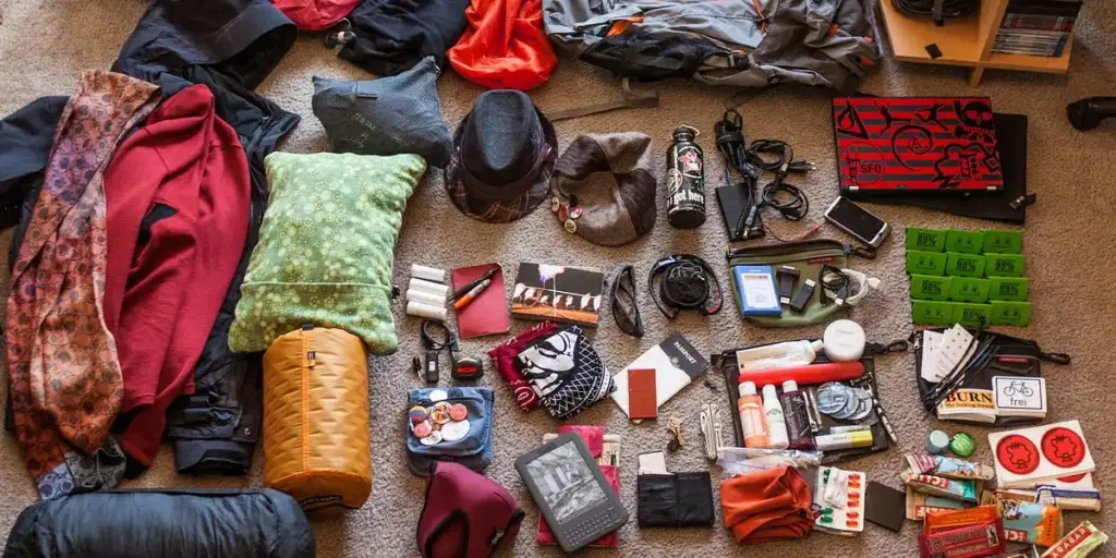
What Should a Solo Female Trekker Pack?
Your exact packing list depends on the route and season, but the basics remain fairly simple.
Clothing: quick-drying base layers, trekking trousers, warm layers, waterproof jacket and rain trousers.
Footwear: broken-in trekking shoes or boots with good grip, plus lightweight footwear for evenings.
Trekking gear: trekking poles, headlamp, daypack, water bottle and a waterproof cover or dry bags.
Health and personal items: basic first aid supplies, blister treatment, personal medication, sunscreen, sunglasses and personal hygiene products.
Documents: passport, permits, insurance details and emergency contacts.
For a detailed route-specific list, it is better to prepare according to the trek rather than carrying a huge generic packing list.
Should You Hire a Guide?
This depends on the route, your experience and the current regulations.
A guide is particularly useful when you are:
trekking at high altitude for the first time
travelling on a remote route
unsure about navigation
uncomfortable making decisions during bad weather
trekking on a route with guide requirements
travelling alone but still wanting someone locally experienced with you
A guide also changes the experience in ways that have nothing to do with safety. They can help communicate with teahouses, explain local customs, adjust the itinerary when conditions change and help you deal with unexpected problems.
For someone who wants to travel alone but does not necessarily want to manage the entire trek alone, a private guided trek can be a good compromise.
Solo Female Trekking With Hi Nepal
If you want the independence of travelling on your own but would rather not manage every trekking detail yourself, Hi Nepal Travels & Treks can arrange a guided trek around your route, dates and preferences.
The useful part is not simply having someone walk beside you. A local trekking team can handle practical details such as permits, accommodation, transportation and route planning while you concentrate on the trek itself.
For solo female travelers, Hi Nepal can also arrange a female guide when available and requested.
The right approach depends on the trek. A short popular route and a remote high-altitude trek should not be treated as the same trip simply because both are called “solo trekking.”
Yes, but do not treat “safe” as a blanket label for every trekking route.
For many women, solo trekking in Nepal is a realistic and rewarding way to travel. The important part is choosing a route that matches your experience and understanding what you are responsible for once you leave the city.
If you are new to trekking, starting with a shorter and more established route such as Poon Hill can make more sense than immediately choosing a remote high-altitude circuit.
If you already have trekking experience, you have more options, but altitude, weather, regulations and trail conditions still need to be taken seriously.
The goal is not to remove every uncertainty from the trek. It is to know which uncertainties you can handle yourself and where having local support makes sense.
Nepal is a popular destination for solo travelers, including women. However, normal travel awareness still matters, and trekking safety depends heavily on the route, weather, altitude and your preparation.
What is the best trek in Nepal for a first-time solo female trekker?
Poon Hill is one of the more approachable choices because it is relatively short and has regular accommodation along the route. Mardi Himal and Annapurna Base Camp can also work for travelers who are prepared for longer and higher trekking days.
Can a woman trek alone to Everest Base Camp?
It depends on the current trekking regulations and your experience. EBC is a high-altitude trek, so the bigger consideration is often whether you are prepared for the altitude, length and changing mountain conditions rather than simply whether you are travelling alone.
Is Manaslu suitable for solo female trekking?
Manaslu is a more demanding choice because it is a restricted trekking region with additional regulations and remote sections. It should not be approached in the same way as a short, popular trek such as Poon Hill.
Should I hire a female trekking guide?
You do not necessarily need a female guide, but some solo female travelers prefer one because they feel more comfortable discussing personal, cultural or practical concerns with another woman. Availability depends on the dates and route.
The Annapurna Circuit is one of the world’s most iconic treks, winding through the Annapurna Conservation Area (ACA), Nepal’s largest protected area at 7,629 sq km. Whether you are crossing the legendary Thorong La Pass (5,416 m), exploring the medieval streets of Manang, or gazing at the sacred shrines of Muktinath, planning starts with understanding one thing: your Annapurna Circuit Trek permits.
Planning your Annapurna Circuit trek in 2026/2027requires careful preparation, and one of the most important steps is understanding the permit requirements and associated costs.
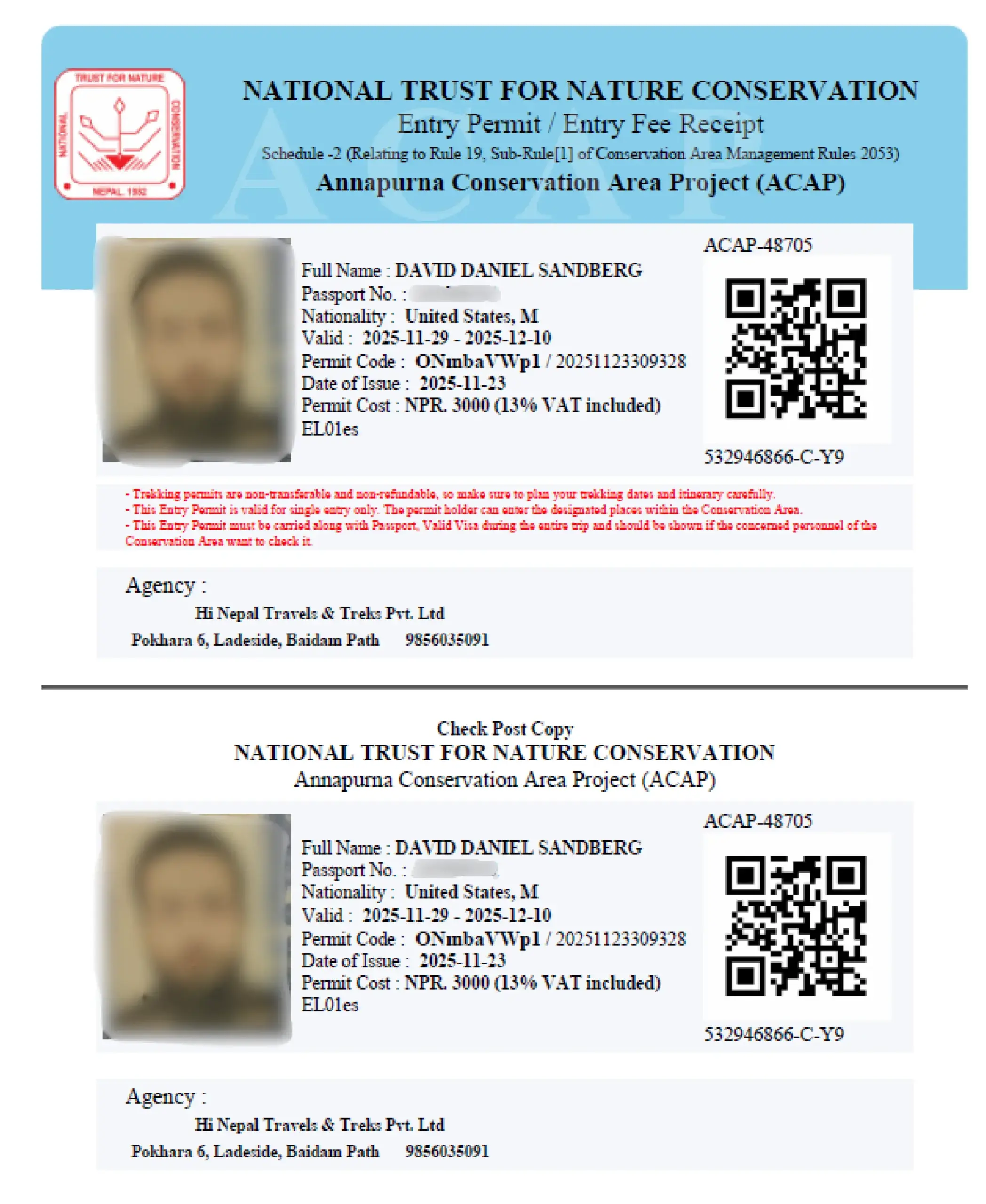
To legally enter and trek this region, every foreign trekker must hold one mandatory permit: the Annapurna Conservation Area Permit (ACAP). This permit grants access to the full circuit, including major trekking hubs such as Manang, Thorong La Pass, Muktinath, Pisang, Chame, and Jomsom.
Nepal’s trekking regulations have changed significantly since 2023. This guide gives you the current, on-the-ground reality, no outdated tables, no recycled misinformation. Just what you actually need to know before you arrive.
Annapurna Circuit Trek Permits in Nepal Overview
Let’s cut straight to what matters. Many blogs still list two permits as mandatory for the Annapurna Circuit. That is no longer accurate. Here is the real picture for 2026:
Permit Type
Requirement Status
ACAP Permit
✅ MANDATORY
TIMS Card
❌ NOT REQUIRED (Annapurna, since April 2023)
The TIMS(Trekkers’ Information Management System) card was officially discontinued for the Annapurna region effective April 1, 2023. In practice, only the ACAP is checked at trail checkpoints. Any source, blog, agency brochure, or forum post, still listing TIMS as a required Annapurna cost is working from outdated information.
The two essential things every trekker must have in 2026 are:
Annapurna Conservation Area Permit (ACAP) – the only mandatory entry permit for the region
A licensed guide from a government-registered trekking agency, legally required for all foreign trekkers since April 2023
Note: Children under 10 years of age are exempt from the ACAP permit fee, but should still be registered at checkpoints for safety and record-keeping.
What Permits Are Required for the Annapurna Circuit Trek in Nepal?
Understanding exactly which permits apply to your trek, and which no longer do is the most important step in your preparation. Here is a clear, honest breakdown.
Annapurna Conservation Area Permit (ACAP) – The Only Mandatory Permit
The ACAP is issued by the National Trust for Nature Conservation (NTNC) and grants legal entry into the Annapurna Conservation Area. It covers the entire standard circuit, including all major trekking hubs: Besisahar, Chame, Pisang, Manang, Thorong La Pass, Muktinath, and Jomsom.
Cost (2026): NPR 3,000 (~$23 USD) for foreign nationals
Cost (2026): NPR 1,000 (~$8 USD) for SAARC nationals
Valid for the full duration of a single entry into the conservation area
Fees fund trail maintenance, wildlife protection, hydropower projects, and local community development
Checked and stamped at multiple official checkpoints along the route
TIMS Card – No Longer Required for Annapurna (Since April 2023)
The TIMS card was a safety-tracking document introduced in 2008. As of April 1, 2023, it has been officially discontinued for the Annapurna region. The mandatory guide system (see below) has replaced its safety-tracking function, your guide’s agency registration ensures your presence on the trail is recorded.
Important note: If an agency charges you separately for a TIMS card on the Annapurna Circuit, ask for written clarification. You are only legally required to pay for the ACAP.
Restricted Area Permits (RAP) – For Optional Side Trips Only
The standard Annapurna Circuit does not require a Restricted Area Permit. RAPs are only needed if you choose to venture off the main circuit into:
Destination
2026 Permit Cost
Notes
Nar Phu Valley
$100/week (peak) $75/week (off-season)
Very remote; requires RAP + guide
Upper Mustang
$50 per day
New daily rate effective Dec 2025 — replaces old $500/10-day flat fee
Tilicho Lake
Covered by ACAP
No additional permit needed
Thorong La Pass
Covered by ACAP
No additional permit needed
Note: The Upper Mustang permit structure changed significantly in December 2025. The old mandatory flat fee of $500 per person for 10 days has been replaced by a flexible $50 per day rate, making short Jeep tours and single-day visits far more accessible.
Why Certain Annapurna Side Trips Require a Restricted Area Permit?
While the main Annapurna Circuit is open to all trekkers with a standard ACAP, certain detours into remote or culturally sensitive areas fall under Nepal’s Restricted Area Permit (RAP) system. Here is why these permits exist and what they protect:
Environmental & Cultural Conservation:
Areas like Nar Phu Valley and Upper Mustang contain fragile high-altitude ecosystems and ancient Tibetan-derived cultures. The RAP limits visitor numbers to prevent over-tourism and funds local heritage preservation.
Enhanced Visitor Tracking:
In remote zones with sparse infrastructure, the RAP system allows the Department of Immigration to monitor trekker movements, critical in areas bordering international boundaries.
Safety & Emergency Response:
Restricted zones involve higher altitudes and more technical terrain. Permit registration ensures trekkers are linked to a licensed agency, making helicopter rescue coordination significantly faster.
Local Community Support:
A portion of RAP fees is allocated directly to the specific districts you traverse, funding schools, health posts, and trail maintenance in villages that see far fewer trekkers than the main circuit.
Mandatory Guide Requirement:
All restricted area treks require a licensed guide and must be arranged through a registered agency, consistent with Nepal-wide 2026 regulations.
Nepal’s permit fee structure for the Annapurna region is straightforward in 2026: one mandatory permit, one fixed price, consistent year-round. There are no peak-season or off-season price differences for the ACAP itself (though guide and accommodation rates do vary by season).
Standard ACAP Permit Fees (2026)
Permit
Foreign Nationals
SAARC Nationals
Status
ACAP (Annapurna Conservation Area Permit)
NPR 3,000 (~$23)
NPR 1,000 (~$8)
Mandatory
TIMS Card
NOT REQUIRED
NOT REQUIRED
Discontinued for Annapurna (April 2023)
Total Permit Cost
NPR 3,000 (~$23)
NPR 1,000 (~$8)
ACAP only
Note: Fees are consistent year-round and have not changed for the 2026 season. Always carry cash in Nepali Rupees (NPR) for in-person applications.
What Does the ACAP Fee Cover?
Trail Maintenance: Upkeep of the physical routes, bridges, signage, and rest areas along the circuit
Wildlife Protection: Conservation programs for snow leopards, Himalayan tahr, and other endemic species
Community Development: Support for schools, health posts, and sustainable energy projects in remote villages
Checkpoint Infrastructure: Operation of official checkpoints at Dharapani, Chame, Manang, Muktinath, and Jomsom
Environmental Monitoring: Scientific research and Leave No Trace enforcement programs
Additional Budget Considerations
Beyond the ACAP permit itself, plan for these essential costs:
Item
Approximate Cost
Notes
Licensed Guide (daily rate)
$25–$35 per day
Legally mandatory for all foreign trekkers
Porter (optional)
$15–$25 per day
Recommended for heavy loads
Travel Insurance
Varies
Must cover heli-evacuation to 6,000m+
Nar Phu RAP (if doing side trip)
$75–$100/week
Only if leaving main circuit
Upper Mustang RAP (if visiting)
$50/day
New 2025 daily rate
Key 2026 Regulation Updates Every Trekker Must Know
If you last researched the Annapurna Circuit before 2023, the regulatory landscape has changed enough that your previous knowledge may get you turned back at a checkpoint. Here is what is new, current, and fully enforced:
1. TIMS Discontinued for Annapurna (April 2023)
The independent Green TIMS Card, previously available directly from NTB for solo trekkers, no longer exists. For the Annapurna region specifically, TIMS in any form is no longer required or enforced on the trail. The mandatory guide registration system has replaced its safety-tracking role.
2. Mandatory Guide Rule – Fully Enforced in 2026
This is the most significant regulatory change for trekkers. Effective April 1, 2023, and rigorously enforced in 2026: every foreign trekker in any National Park, Conservation Area, or Restricted Area in Nepal must be accompanied by a licensed guide from a TAAN-registered trekking agency.
Trekkers found without a licensed guide are turned back at checkpoints
Purchased permits become invalid if you are trekking without a guide
Checkpoints throughout the Annapurna region actively verify guide credentials
Attempting to continue without a guide can result in fines or blacklisting from future permits
Note: This rule applies regardless of your experience level, nationality, or previous trekking history in Nepal. There are no exceptions for the major routes.
The old $500 flat fee for a mandatory 10-day Upper Mustang permit has been replaced by a $50 per person per day system, effective December 22, 2025 (Paus 7 in the Nepali calendar). This landmark change makes shorter visits – Jeep tours, motorcycle trips, 2–3 day treks, significantly more affordable and is expected to increase visitor numbers to the region. ACAP fees and mandatory guide requirements remain in place.
5. Digital Permit Applications Now Available
Nepal has transitioned to digital permit tracking in 2026. Permits can be applied for online using your Nepali visa number, and international applicants can pay fees in advance before arriving in Kathmandu. Your trekking agency can typically handle the entire process digitally on your behalf. Note that physical permit documents are still required at trail checkpoints, keep originals in a waterproof sleeve.
6. Travel Insurance Enforcement Tightened
Travel insurance with helicopter evacuation coverage has been mandatory for years, but enforcement is stricter in 2026. Most reputable agencies now require a copy of your insurance policy before the trek commences. Your policy must specifically include:
Emergency helicopter evacuation coverage to altitudes of at least 6,000 metres
Medical treatment for altitude-related conditions (AMS, HACE, HAPE)
Medical repatriation coverage
Important note: Standard travel insurance without explicit high-altitude provisions does not meet this requirement. Check your policy carefully before departing.
Annapurna Trek Permit Cost vs. Other Nepal Treks (2026)
When planning a Himalayan adventure, understanding how permit costs compare across Nepal’s major trekking regions helps you budget accurately and choose the right route for your goals.
Trek
Required Permits
Approx. Total Permit Cost (USD)
Best For
Annapurna Circuit
ACAP only
~$23
Variety, culture & value
Everest Base Camp
Sagarmatha NP + Local Entry Permit (LEP)
~$45–$50
Iconic peaks & Sherpa culture
Langtang Valley
Langtang NP Permit
~$23–$35
Shorter duration, fewer crowds
Manaslu Circuit
RAP + MCAP + ACAP
~$175–$205
Remote, restricted adventure
Upper Mustang
RAP ($50/day) + ACAP
$500+ for 10 days
Tibetan culture & unique landscape
Key Differences at a Glance
Annapurna vs. Everest Base Camp
The Everest region uses a unique Local Entry Permit (LEP) system through the Khumbu Pasang Lhamu Rural Municipality, replacing TIMS in that region. While permit costs are broadly similar to Annapurna, Everest has notably higher on-trail costs for accommodation and food, and the permit structure is slightly more complex.
Annapurna vs. Manaslu (Restricted Area)
The Manaslu Circuit sits entirely within restricted area territory, meaning its permit costs are seasonal and significantly higher. Unlike the Annapurna Circuit, permits for Manaslu must be processed by a registered agency, you cannot apply individually. This makes it better suited for trekkers specifically seeking a remote, off-the-beaten-path experience.
Annapurna vs. Upper Mustang (Premium Route)
Upper Mustang is one of Nepal’s most expensive regions to trek due to its restricted area status. However, the new daily rate system introduced in December 2025 has made shorter trips to Lo Manthang much more financially accessible than before. If you are considering adding Mustang to your Annapurna trip, budget an additional $50 per day for the RAP alone.
How to Get Annapurna Circuit Trek Permits in Nepal?
Getting your ACAP permit is straightforward, the key is doing it before you start the trail. Here is a step-by-step guide for 2026.
Step 1: Gather Your Documents
Whether applying in person or through your agency, have these ready before arrival:
Original passport valid for at least 6 months from your Nepal entry date
Valid Nepal tourist visa (15, 30, or 90 days) covering your full trekking period
2–4 passport-sized photographs (physical copies required even for digital applications)
General trekking itinerary with entry and exit points
Proof of travel insurance explicitly covering high-altitude trekking and heli-evacuation
Step 2: Choose Your Application Method
Option A — In Person (Kathmandu or Pokhara)
Visit the ACAP/NTNC office or Nepal Tourism Board:
Kathmandu: Bhrikutimandap, Thamel area, open Sunday to Friday, 10:00 AM to 5:00 PM
Pokhara: Lakeside/Damside, open Sunday to Friday, 10:00 AM to 5:00 PM
Bring exact cash in Nepali Rupees, most offices do not accept credit cards for walk-in applications
Walk-out time is typically 30–60 minutes if not busy
Pro Tip: Government offices are closed on Saturdays and public holidays. Plan to arrive in Kathmandu at least one full business day before your trek starts.
Option B — Through Your Registered Agency (Recommended)
This is the smoothest route in 2026 given the mandatory guide requirement. Your agency applies for the ACAP using their official credentials, often before you even arrive in Nepal. Provide them with a digital copy of your passport and photos in advance, and your permit will be waiting at your pre-trek briefing.
Option C — Online Pre-Registration
Nepal now allows online permit applications using your Nepali visa number. International applicants can pay fees in advance. However, you will still need to visit a physical counter in Kathmandu or Pokhara to collect your stamped physical permit booklet before heading to the mountains.
Step 3: On the Trail
Carry original permits in a waterproof sleeve at all times, digital copies are backup only
Register your permit at every official checkpoint (Dharapani, Chame, Manang, Muktinath, Jomsom)
Your guide is jointly responsible for checkpoint registration, do not skip any checkpoint
Important note: Do not attempt to buy your ACAP at a trailhead checkpoint. Trekkers issued permits on the trail are typically charged double the standard rate as a penalty for non-compliance.
Mandatory Requirements for Annapurna Circuit Trek Permits in Nepal
Beyond the ACAP permit itself, Nepal’s 2026 regulations establish a broader set of requirements for foreign trekkers. Meeting all of these before you set foot on the trail ensures a legal, safe, and stress-free journey.
Core Identification & Legal Documents
Original passport – valid for at least 6 months from your Nepal entry date
Valid Nepal tourist visa, must cover your full trekking duration plus buffer days
4–6 passport-sized photographs for permits, registration forms, and checkpoints
Digital copies of passport, visa, and insurance stored securely on your phone or in the cloud
Mandatory Trekking Permits
ACAP Permit — NPR 3,000 (~$23) for foreign nationals; NPR 1,000 (~$8) for SAARC nationals. The single mandatory entry document for the Annapurna region.
TIMS Card — Not required for Annapurna as of April 2023. Do not pay for this separately.
The No Solo Trekking Rule (Fully Enforced 2026)
This is the most important practical requirement for 2026. Every foreign trekker must be accompanied by a licensed guide from a TAAN-registered agency. This is not optional, not loosely enforced, and has no exceptions for the Annapurna Circuit and other major trekking regions.
Checkpoints actively verify guide credentials alongside your ACAP permit
Trekkers found without a licensed guide are turned back; permits become invalid
Guide daily rate: $25–$35 per day; porter rates: $15–$25 per day
One licensed guide may lead up to seven trekkers
Mandatory Travel Insurance
Proof of insurance is required before your trek commences. Your policy must explicitly cover:
High-altitude trekking to at least 6,000 metres
Emergency helicopter evacuation (typical cost: $3,000–$7,000 per rescue)
Medical treatment for altitude-related illness in Kathmandu or Pokhara
Medical repatriation to your home country
Pro Tip: Purchase your insurance before leaving your home country. Nepal-based policies often exclude pre-existing conditions and may not meet the heli-evacuation threshold.
Age & Health Considerations
There is no strict upper age limit for the Annapurna Circuit, but the trek reaches 5,416 m at Thorong La Pass. Physical fitness and cardiovascular health are essential. Disclose any pre-existing conditions, particularly respiratory, cardiac, or previous altitude sickness history, to your guide before departure. Children under 10 are exempt from the ACAP fee but must still be registered at checkpoints.
Terms and Conditions for Annapurna Circuit Trek Permits
Understanding the legal terms attached to your ACAP permit avoids surprises and potential penalties on the trail.
Single-Entry Validity: The ACAP is valid for one entry only. If you exit the conservation area and wish to re-enter, you must purchase a new permit at full price.
Non-Transferable: Permits are issued in your name and cannot be shared, loaned, or transferred to another trekker under any circumstances.
ID Required at All Times: Carry your original passport alongside your physical permit. Checkpoint officials cross-reference both documents; a photocopy of your passport alone may not be accepted.
Non-Refundable: Once issued, permit fees are 100% non-refundable and non-exchangeable, regardless of weather conditions, injury, illness, or changes to your travel plans.
Guide Compliance: Your permit remains valid only while you are trekking with your licensed guide. Separating from your guide without authorisation may void your permit.
Route Adherence: Your permit covers the approved Annapurna Circuit route. Entering restricted areas (Nar Phu, Upper Mustang) without the appropriate RAP is a legal violation and may result in fines.
Environmental Compliance: Permit holders are bound by Nepal’s National Park and Wildlife Conservation Act. Littering, disturbing wildlife, or damaging flora is strictly prohibited and enforceable.
Checkpoint Registration: You and your guide are jointly responsible for registering at every official checkpoint. This data is the backbone of Nepal’s search and rescue coordination system.
Pro Tip: Store your ACAP in a waterproof dry bag or laminated sleeve. High-altitude weather can arrive without warning, a rain-soaked, illegible permit causes unnecessary delays at checkpoints like Thorong Phedi or Jomsom.
Ready to Trek the Annapurna Circuit?
At Hi Nepal Treks, we handle your ACAP permit, licensed guide, and all logistics, so you can focus entirely on the trail ahead. Contact us to plan your 2026/27 Annapurna Circuit adventure.
FAQ
Do I need a TIMS card for the Annapurna Circuit in 2026?
No. The TIMS card was officially discontinued for the Annapurna region effective April 1, 2023. Only the ACAP is required and enforced at trail checkpoints. If an agency quotes you a separate TIMS fee for the Annapurna Circuit, ask for written clarification, it is not a legal requirement.
What are the mandatory permits for the Annapurna Circuit trek?
One permit: the Annapurna Conservation Area Permit (ACAP). This grants access to the full circuit. In addition to the permit, a licensed guide from a registered agency is legally required for all foreign trekkers.
How much does the ACAP permit cost in 2026?
NPR 3,000 (approximately $23 USD) for foreign nationals. SAARC nationals (India, Bangladesh, Bhutan, Pakistan, Sri Lanka, Maldives, Afghanistan) pay a discounted rate of NPR 1,000 (~$8 USD). Fees are consistent year-round and have not changed for the 2026 season.
Is solo trekking allowed on the Annapurna Circuit?
Not for foreign trekkers. Since April 1, 2023, all foreign nationals must be accompanied by a licensed guide from a TAAN-registered trekking agency when trekking in any National Park, Conservation Area, or Restricted Area in Nepal. Trekkers found without a guide are turned back at checkpoints.
Can solo travellers now do restricted area treks?
Yes, as of March 22, 2026. TAAN removed the previous requirement for a minimum of two trekkers per group in restricted areas. Individual trekkers can now obtain RAPs and trek alone, provided they are accompanied by a licensed guide and book through a registered agency.
Where can I get the ACAP permit?
ACAP/NTNC offices in Kathmandu (Bhrikutimandap) or Pokhara (Lakeside/Damside), open Sunday–Friday, 10:00 AM–5:00 PM. A registered trekking agency can also handle the full application process before you arrive. Online pre-registration is also available using your Nepali visa number, though physical permit collection is still required.
What documents do I need to apply?
A valid passport and photocopy; a valid Nepal tourist visa; 2–4 passport-sized photographs; cash in NPR for in-person applications; and proof of travel insurance covering high-altitude trekking and helicopter evacuation.
Are permit costs different in peak vs. off-season?
No. ACAP fees are fixed year-round at NPR 3,000 for foreign nationals. However, guide fees and teahouse accommodation prices are typically 15–25% higher during peak seasons (March–May and September–November).
How long is the permit valid?
Permits are issued for a single entry and remain valid for the duration of your trek as specified in your application itinerary. Once you exit the conservation area, typically at Jomsom or Tatopani, the permit cannot be reused.
Does the ACAP cover Tilicho Lake and Thorong La Pass?
Yes. The standard ACAP covers the entire Annapurna Circuit, including the side trip to Tilicho Lake and the crossing of Thorong La Pass (5,416 m). Separate RAPs are only needed if you plan to enter Nar Phu Valley or Upper Mustang.
What happened to Upper Mustang’s permit fee?
In December 2025, Nepal replaced the old $500 flat fee (mandatory for 10 days) with a flexible $50 per day system. This makes shorter trips to Upper Mustang, whether by Jeep, motorcycle, or trekking, significantly more affordable. ACAP fees and guide requirements remain unchanged.
Can I get my permit on the trail?
Technically, some checkpoint offices can issue permits at trailheads like Besisahar, but trekkers issued permits on the trail are typically charged double the standard rate. Always obtain your ACAP in Kathmandu or Pokhara before your trek begins.
Do children need permits?
Children under 10 years of age are exempt from the ACAP permit fee. However, their presence must still be reported at the registration office for safety and record-keeping, and they should carry their passport at trail checkpoints.
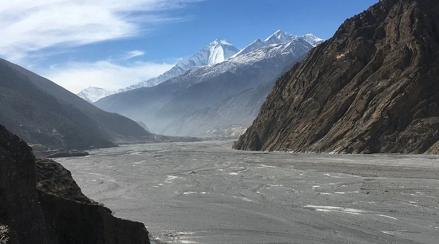
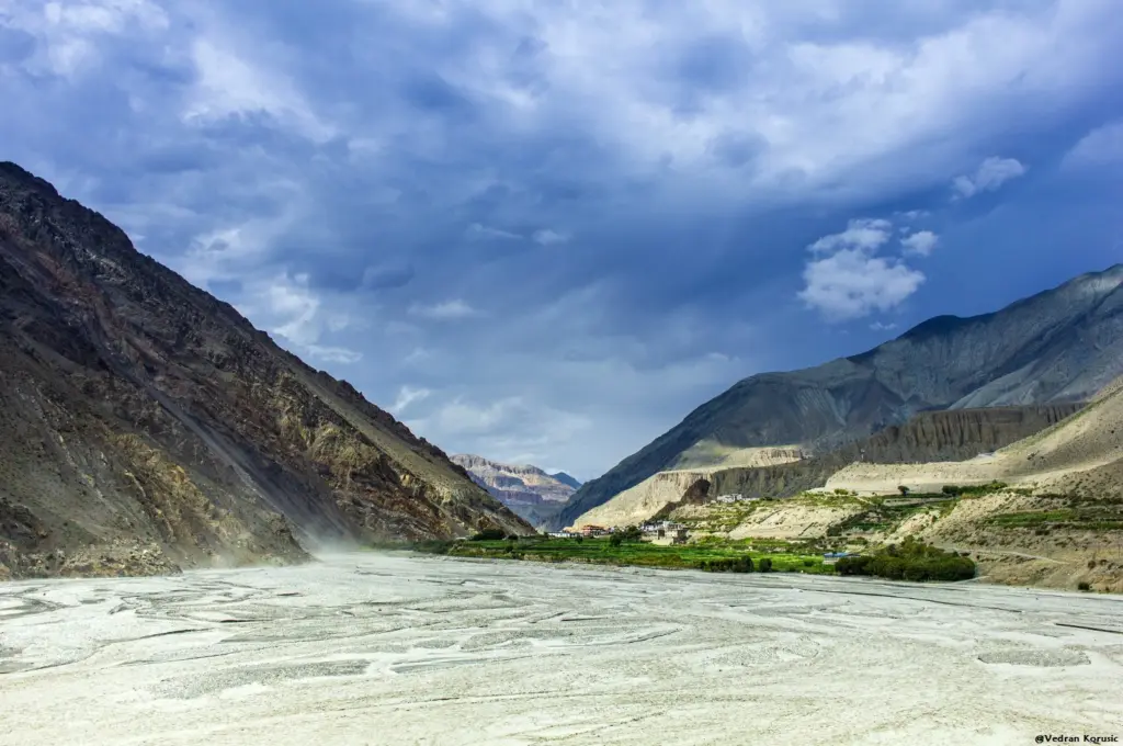
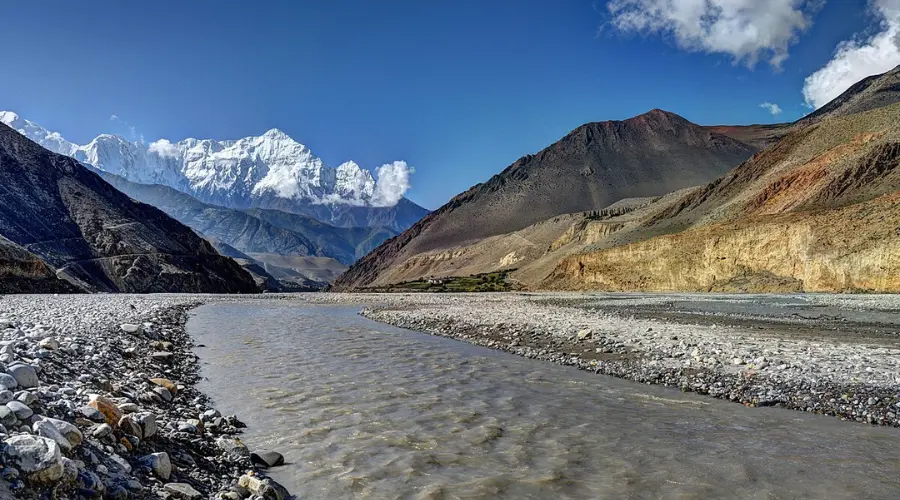
Imagine standing in a spot where the earth literally splits open, carving a path so profound it defies logic. While most travelers look up at the soaring peaks of the Nepal Himalayas, there is a silent giant hiding right before their eyes. Welcome to the Kali Gandaki Gorge, a geological marvel widely regarded as one of the deepest gorge in the world.
Tucked between the towering giants of Annapurna and Dhaulagiri, this ancient valley is more than just a gap in the landscape; it is a bridge between worlds. Whether you are a seeker of ancient myths or a lover of rugged trails, there is a story here that remains largely untold.
In this blog, we’ll dive into the fascinating geography, the sacred history, and the vibrant culture that makes trekking through this canyon a true once-in-a-lifetime adventure. Let’s explore the mystery of the Kali Gandaki.
Where is the Kali Gandaki Gorge Located?
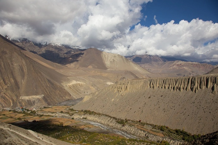
To find the Kali Gandaki Gorge, you must look toward the heart of the Nepal Himalayas, specifically the rugged and mystical Mustang region. This legendary canyon acts as a natural divider between two of the world’s most formidable peaks: Annapurna I to the east and Dhaulagiri to the west. Both mountains soar above 8,000 meters, creating a staggering vertical drop that places this gorge among the deepest in the world.
For travelers, this means you are walking through a valley that has served as a vital trade route between Tibet and India for centuries. Whether you’re heading toward Jomsom or exploring the high deserts of Upper Mustang, the gorge is your constant, awe-inspiring companion.
Why is Kali Gandaki Considered One of the Deepest Gorges in the World?
What makes the Kali Gandaki Gorge so legendary isn’t just its beauty, but its staggering scale. To understand why it’s one of the deepest gorges in the world, look at the math of the Nepal Himalayas. The riverbed sits at an elevation of about 2,520 meters, while the peaks of Annapurna and Dhaulagiri tower over 8,000 meters just a few miles away. This creates a vertical drop of more than 5,500 meters, a measurement that rivals any gorge on Earth.
To put that in perspective, the famous Grand Canyon in the USA reaches a depth of about 1,800 meters. The Kali Gandaki is nearly three times deeper by this measure.
While the title of “world’s deepest gorge” is debated by geographers, with the Yarlung Tsangpo in Tibet and Cotahuasi Canyon in Peru also making strong claims, few places on Earth can match the sheer drama of standing at the bottom of this canyon, hemmed in by two of the highest mountains in the world.
Here, the river flows through the mountains rather than around them, the result of millions of years of tectonic movement. It is a humbling reminder of nature’s raw power.
An Ancient Gateway: The Historic Salt Trade Route
Long before modern roads reached the remote corners of the Nepal Himalayas, the Kali Gandaki Gorge served as a vital artery for the region. For centuries, this massive canyon was the primary link between the high plateau of Tibet and the lush valleys of Nepal and India. It wasn’t just a path, it was a lifeline.
Known famously as the “Salt Trade Route,” the gorge saw endless caravans of yaks and mules laden with precious salt from the dried lakebeds of Tibet. In exchange, traders from the south brought grain, spices, and other goods to the mountain communities. You can almost still hear the rhythmic clanging of mule bells echoing off the steep canyon walls, a sound that has defined this journey for generations.
Walking through the deepest gorge in the world today, you are literally stepping in the footprints of ancient merchants. This history has left behind a rich tapestry of culture, seen in the traditional stone teahouses and the unique blend of Buddhist and Hindu traditions that still thrive in the villages along the river. It’s a place where history isn’t found in books, but in the very dust of the trail.
The Sacred Soul: Spirituality and the Kali Gandaki
Beyond its geological wonders, the river flowing through the Kali Gandaki Gorge holds a deep spiritual significance that resonates through the Nepal Himalayas. For Hindus and Buddhists alike, this isn’t just water, it is a sacred presence.
The most mystical aspect of the river is the presence of Shaligrams. These are ancient, black fossilized ammonites, remnants of a time when the Himalayas lay beneath a prehistoric sea, found in the Kali Gandaki riverbed and the surrounding Mustang region.
To Hindus, each Shaligram is a natural manifestation of Lord Vishnu, the preserver of the universe. Finding one is considered a divine blessing, and they are treated with the utmost reverence in homes and temples across the world.
As you trek through the gorge, you’ll often see pilgrims bowed by the riverbank, searching the silt for these prehistoric treasures. There is a quiet, powerful energy here. The roar of the river sounds like a constant chant, reminding every traveler that this landscape is as much a spiritual sanctuary as it is a natural marvel. It’s a place where the earth’s ancient past and living faith flow together as one.
Life Within the Shadows of the Giants
Living in the Kali Gandaki Gorge is a testament to human resilience. As you move deeper into the Nepal Himalayas, the landscape shifts dramatically from lush greenery to a high-altitude desert that feels like another planet. This is the heart of Thakali culture, a community world-renowned for their incredible hospitality and their famous, hearty mountain cuisine.
In legendary villages like Jomsom and Kagbeni, life is dictated by the rhythm of the mountains. Jomsom, the bustling hub of the region, is famous for its powerful afternoon winds that howl through the canyon. These winds are so consistent that they have shaped the local architecture. Houses are built with flat roofs and heavy stones to keep everything secure. Further along, the medieval village of Kagbeni stands as a stunning mud-brick gateway to the forbidden kingdom of Upper Mustang, where ancient traditions remain untouched by time.
The terrain here is rugged and dry, yet the local people have carved out a vibrant existence. From the sweet apple orchards of Marpha to the silent, cliffside monasteries, life in the deepest gorge in the world is a beautiful blend of hard work and spiritual peace. For any traveler, witnessing this unique lifestyle is just as rewarding as seeing the snow-capped peaks themselves.
Trekking Through the Depths: The Annapurna Circuit Experience
Trekking through the Kali Gandaki Gorge is a highlight of the classic Annapurna Circuit, offering a dramatic transition that few other trails can match. As you move through the deepest gorge in the world, the scenery shifts from the lush, subtropical forests of the lower hills to the stark, wind-swept landscapes of the high desert.
One of the most rewarding stops is Tatopani, where you can soak your tired muscles in natural riverside hot springs. From there, the trail leads you to the bustling town of Jomsom, the gateway to the Mustang region. Be prepared for the famous afternoon “wind tunnel” of the gorge, a powerful breeze that carries the scent of pine and ancient dust. The journey eventually takes you to the sacred site of Muktinath at 3,800 meters, where 108 stone spouts and an eternal flame draw pilgrims from across the Nepal Himalayas.
In terms of difficulty, this section is generally considered moderate. While the terrain is rugged, the paths are well-established and supported by comfortable teahouses. The main challenge for trekkers is the gradual gain in altitude and the dusty afternoon winds. However, the reward is an immersive journey through a landscape that feels as though it was carved by the gods themselves. It is an essential experience for anyone wanting to see the true heart of the mountains.
Best Time to Visit the Kali Gandaki Gorge
Timing is everything when planning a trip to the Nepal Himalayas. To see the Kali Gandaki Gorge in all its glory, you will want to aim for the two peak trekking seasons.
Autumn (September to November) is widely considered the best time. After the summer rains, the air is incredibly crisp and the sky is a deep blue, offering the sharpest views of the surrounding 8,000-meter peaks. This is also a festive time in Nepal, adding a vibrant cultural layer to your journey.
Spring (March to May) is another favorite for travelers. The weather is comfortably warm, and as you trek through the lower parts of the gorge, you’ll be treated to forests of blooming rhododendrons.
While the deepest gorge in the world is a marvel year-round, the monsoon season (June to August) is usually not ideal. Heavy rains can make the trails slippery and often hide the magnificent mountain views behind thick clouds. For the most comfortable and scenic experience, sticking to the spring or autumn months ensures your adventure is truly unforgettable.
What Makes the Kali Gandaki Gorge Truly Unique?
What sets the Kali Gandaki Gorge apart is its sheer, dramatic contrast. It is the only place on Earth where you can stand on a valley floor and look up at two massive 8,000-meter peaks Annapurna I and Dhaulagiri towering directly on either side of you. This unique geography is what officially defines it as the deepest gorge in the world.
But its uniqueness goes beyond the height of the mountains. In the Nepal Himalayas, few places offer such a raw blend of natural wonder and cultural soul. From the prehistoric fossils found on the riverbanks to the ancient Thakali villages, the gorge is a living museum. It is a rare destination where the power of nature and centuries of human history meet in perfect harmony.
Practical Travel Tips for Your Journey
Exploring this remarkable gorge is an incredible adventure, but a little preparation goes a long way. Here are some practical tips to help you navigate the Kali Gandaki like a pro:
Secure Your Permits: You will need the Annapurna Conservation Area Project (ACAP) permit and a TIMS (Trekkers’ Information Management Systems) card. If you plan to head north of Kagbeni into Upper Mustang, a special Restricted Area Permit is required.
Pack for Dust and Wind: The Nepal Himalayas are famous for strong afternoon winds, especially in the Jomsom area. Bring a high-quality buff or scarf to protect your face from dust, along with windproof outer layers.
Layer Up: Temperatures can shift rapidly. Carry moisture-wicking base layers for the sunny daytime walks and a warm down jacket for the chilly mountain evenings.
Hire a Local Guide: While the trails are well-marked, a local guide is invaluable. They can help you spot hidden Shaligrams, bridge the language gap in remote villages, and provide deep insights into the local culture and history that you won’t find in any guidebook.
Stay Hydrated: The air is dry and the sun is intense at high altitudes. Carry a reusable water bottle and use purification tablets or a filter to stay hydrated while protecting the environment.
Experience the Magic of the Kali Gandaki Gorge
The Kali Gandaki Gorge is far more than a geographical record-holder, it is a journey through the very soul of the Nepal Himalayas. From the sacred whispers of the river to the towering shadows of Annapurna and Dhaulagiri, every step through this ancient canyon tells a story of trade, faith, and extraordinary resilience. Whether you are hunting for prehistoric fossils or simply seeking a perspective that only the high mountains can offer, this gorge delivers an experience that stays with you long after the dust has settled.
The legends of this valley are waiting to be explored, and there is no better way to uncover them than by walking these historic trails yourself. Reach out to a reputable local trekking agency to begin planning your Himalayan journey, your adventure into the deep awaits.
Frequently Asked Questions About the Kali Gandaki Gorge
Where is the Kali Gandaki Gorge located?
The Kali Gandaki Gorge is located in the Mustang region of the Nepal Himalayas. It sits dramatically between two of the world’s highest mountains: Annapurna I (8,091m) and Dhaulagiri (8,167m). This unique position creates a massive natural corridor that has connected Nepal and Tibet for centuries.
Is it really the deepest gorge in the world?
The Kali Gandaki is widely cited as one of the deepest gorges on Earth, with a vertical drop of over 5,500 meters between the riverbed and the surrounding peaks. However, the title is geographically contested, with the Yarlung Tsangpo in Tibet and Cotahuasi Canyon in Peru also considered strong candidates. What’s undisputed is that the scale and drama of this canyon place it among the world’s most extraordinary natural formations.
Is it safe to trek through the Kali Gandaki Gorge?
Yes, trekking through the gorge is very safe for most travelers. The trails are well-established parts of the Annapurna Circuit. The strong afternoon winds in the Jomsom area can be quite dusty, so wearing a buff and staying hydrated is important.
What is the best time of year to visit?
The best times to visit are autumn (September to November) and spring (March to May). During these seasons, skies are clear with excellent mountain views and stable trekking conditions.
Do I need special permits to visit the Kali Gandaki Gorge?
Most travelers need the Annapurna Conservation Area Project (ACAP) permit and a TIMS card. If your journey extends into Upper Mustang, a special Restricted Area Permit is also required. A reputable trekking agency can help you arrange all of these.
What are Shaligrams and where are they found?
Shaligrams are black, fossilized ammonites found in the Kali Gandaki riverbed and the surrounding Mustang region. In Hinduism, they are considered sacred manifestations of Lord Vishnu. Many pilgrims and trekkers search for these ancient stones along the riverbanks as they journey through the canyon.
How difficult is the Kali Gandaki trek?
The trek is generally considered moderate. While the terrain is rugged, the elevation gain is more gradual compared to other high-altitude treks in the Nepal Himalayas, making it suitable for anyone with a reasonable level of fitness, provided they allow time to acclimatize properly.
Can I see both Annapurna and Dhaulagiri from the gorge?
Absolutely. The Kali Gandaki Gorge offers one of the rare vantage points on Earth from which you can see two separate 8,000-meter peaks from the valley floor. The contrast between the riverbed and the towering snow-capped summits is truly extraordinary.
What kind of accommodation is available in the gorge?
The route is dotted with charming teahouses, local mountain guesthouses that provide warm beds and delicious local meals, including the famous Thakali Khana set. In larger towns like Jomsom, more modern hotels with increased comfort and amenities are also available.
Why is the Kali Gandaki historically significant?
For centuries, the gorge served as the legendary Salt Trade Route, the main highway for traders carrying salt from Tibet south into Nepal and India. This history created a unique cultural blend of Buddhist and Hindu traditions that travelers still encounter today.
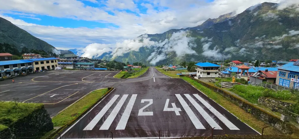
If you’ve ever dreamed of trekking to Everest Base Camp, your journey almost certainly begins at one of the most thrilling, and terrifying, airports on earth. Lukla Airport, also known as Tenzing-Hillary Airport, is a tiny airstrip perched high in the Himalayas of Nepal. It has earned a global reputation as the most dangerous airport in the world, and once you understand its geography, altitude, and runway specs, you’ll know exactly why.
Where Is Lukla Airport?
Lukla Airport is located in the Solukhumbu District of the Koshi Province in northeastern Nepal, in the small Sherpa town of Lukla. The airport sits within the Khumbu region, the gateway to the mighty Mount Everest.
The nearest major city is Kathmandu, the capital of Nepal, from which Lukla is about 140 kilometers (87 miles) to the northeast. There are no roads connecting Kathmandu to Lukla, which means the only practical way to reach the Khumbu region quickly is by air, making this airport not just famous, but absolutely essential.
Lukla Airport Fast Facts
Feature
Detail
Official Name
Tenzing-Hillary Airport
Location
Lukla, Solukhumbu District, Nepal
IATA Code
LUA
ICAO Code
VNLK
Altitude
2,860 m (9,383 ft) above sea level
Runway Length
527 m (1,729 ft)
Runway Gradient
~11.7% (uphill from south to north)
Aircraft Types
Twin Otter, Pilatus PC-6, helicopters
Built
1964
Named After
Sir Edmund Hillary & Tenzing Norgay Sherpa
A Brief History of Lukla Airport
Lukla Airport was built in 1964, largely thanks to the efforts of Sir Edmund Hillary, the legendary New Zealand mountaineer who, along with Tenzing Norgay Sherpa, became the first person to summit Mount Everest in 1953. Hillary helped fund and construct the airstrip to support the growing number of trekkers and expedition teams heading into the Khumbu region.
In honor of both Hillary and Tenzing Norgay, the airport was officially renamed Tenzing-Hillary Airport in 2008. Despite the formal name, the world still widely refers to it as Lukla Airport.
Lukla Airport Altitude: How High Is It?
One of the most striking facts about this airport is its extreme elevation. Lukla Airport altitude stands at approximately 2,860 meters (9,383 feet) above sea level. This makes it one of the highest commercial airports in the world.
Flying at this altitude presents unique challenges:
Thinner air reduces engine performance and lift, meaning aircraft must use shorter takeoff and landing distances with less margin for error.
Unpredictable mountain weather – including sudden fog, strong crosswinds, and low-visibility cloud cover – can close the airport for hours or even days.
Hypoxia risk for passengers and crew who are not acclimatized to high altitude.
Rapid weather changes mean a flight can be cleared for takeoff and encounter a wall of cloud within minutes.
The altitude alone would make Lukla challenging enough. But combine it with the runway, and things get truly extreme.
Lukla Airport Runway Length: How Short Is It?
Here’s where things get genuinely hair-raising. Lukla Airport’s runway length is just 527 meters (1,729 feet), one of the shortest commercial runways in the world.
To put that in perspective, a standard international airport runway is typically between 2,500 and 4,000 meters long. Lukla’s runway is roughly five to eight times shorter than a normal runway.
But the length isn’t even the most alarming part. The runway at Lukla Airport has several extreme characteristics:
A steep gradient of approximately 11.7% – the runway slopes sharply uphill from south to north. Planes land going uphill to slow down faster, and take off going downhill to gain speed more quickly.
The runway ends at a cliff on one side and a mountain wall on the other, there is absolutely no room for error or overrun.
No go-around option from the northern end – once a plane is committed to landing, there is no safe way to abort and circle back.
Only specially trained pilots flying STOL (Short Take-Off and Landing) aircraft are permitted to operate at Lukla. The most common aircraft seen here are the Twin Otter and the Pilatus PC-6, both rugged, reliable planes built for exactly these kinds of extreme conditions.
Why Is Lukla Airport Considered the Most Dangerous Airport in the World?
Lukla Airport has been ranked the most dangerous airport in the world by multiple aviation organizations, travel publications, and even the History Channel. The combination of factors that make it so risky is truly unique:
1. Extreme Altitude
At nearly 2,860 meters above sea level, aircraft performance is significantly reduced. Pilots have less engine power and less aerodynamic lift to work with.
2. Minimal Runway Length
With only 527 meters of runway and no room for overrun on either end, one end drops off a cliff, the other meets a sheer rock face, precision is everything. A miscalculation of even a few meters can be fatal.
3. Severe Gradient
The 11.7% slope of the runway means that landings and takeoffs behave very differently than at flat airports. The uphill slope assists braking during landing but demands perfect technique every single time.
4. Unpredictable Himalayan Weather
Mountain weather is notoriously unstable. Pilots often fly under Visual Flight Rules (VFR), which means they must be able to see where they are going. When clouds roll in, which they do frequently, flights are grounded. On a bad weather day, dozens of flights can pile up, creating operational pressure that can affect judgment.
5. No Instrument Landing System (ILS)
Lukla Airport does not have an Instrument Landing System, which means pilots cannot rely on electronic guidance to land in poor visibility. Everything depends on the pilot’s eyes and skill.
6. One-Way Traffic Pattern
Due to the terrain surrounding the airport, aircraft can only approach and depart from one direction. This eliminates flexibility and increases risk if conditions change mid-approach.
7. Accident History
Over the decades, Lukla has seen a number of serious incidents and fatal crashes. Notable accidents have occurred in 2008, 2010, and 2013, involving different aircraft and circumstances, but all reflecting the inherent dangers of this extraordinary airport.
Who Flies to Lukla Airport?
Only a small number of certified Nepal airlines operate scheduled service between Kathmandu’s Tribhuvan International Airport and Lukla Airport. These include:
Tara Air
Summit Air
Sita Air (operated until a crash in 2012)
Helicopter services are also common, especially for emergencies, VIP trekkers, or when fixed-wing flights are grounded due to weather.
Flights from Kathmandu to Lukla take approximately 25 to 40 minutes, but they are among the most scenic and adrenaline-inducing short-haul flights you’ll ever experience, flying low over dramatic green hills before suddenly descending into a tiny mountain airstrip framed by snow-capped peaks.
2. Build in buffer days. Weather cancellations are extremely common. Budget at least 1–2 extra days on each side of your Lukla flight to account for delays.
3. Fly early in the morning. Most Lukla flights depart between 6 AM and 9 AM, before afternoon winds and clouds make flying impossible.
4. Pack light. Small aircraft have strict baggage limits, typically 15 kg of checked baggage and 5 kg of carry-on for most carriers.
5. Don’t fight the weather. If your flight is cancelled, accept it gracefully. Pilots and airlines make conservative calls for a reason, the mountains are unforgiving.
6. Stay calm. Yes, the approach is dramatic and the runway is short. But the pilots who fly this route are among the most experienced mountain aviators in the world. Trust them.
Final Thoughts: Is Lukla Airport Worth the Risk?
Despite its fearsome reputation as the most dangerous airport in the world, hundreds of thousands of trekkers fly through Lukla Airport every year without incident. Modern aircraft, highly trained pilots, and strict weather protocols have improved safety significantly over the decades.
The risk is real, but so is the reward. From the moment your small aircraft drops onto that steep uphill runway and you step out into the cool, thin Himalayan air, you know you’ve arrived somewhere extraordinary. The trail to Everest Base Camp stretches ahead of you, and the adventure of a lifetime begins.
Understanding Lukla Airport’s altitude, its runway length, its location, and the reasons it’s been called the world’s most dangerous airport only deepens your respect for the pilots, the mountains, and the incredible human spirit that drives people to come here from every corner of the globe.
FAQ’s
What is Lukla Airport officially called?
Lukla Airport is officially named Tenzing-Hillary Airport, named in honor of Sir Edmund Hillary and Tenzing Norgay Sherpa, the first two climbers to summit Mount Everest. It was renamed in 2008, though the world still widely refers to it as Lukla Airport.
Why is Lukla Airport considered the most dangerous airport in the world?
Lukla Airport is considered the most dangerous airport in the world due to a combination of extreme factors: a very short runway of only 527 meters, a steep 11.7% gradient, high altitude at 2,860 meters above sea level, unpredictable Himalayan weather, no Instrument Landing System (ILS), and terrain on both ends of the runway that leaves zero room for error.
Where is Lukla Airport located?
Lukla Airport is located in Lukla town, Solukhumbu District, Koshi Province, northeastern Nepal. It sits in the Khumbu region of the Himalayas and serves as the main entry point for trekkers heading to Everest Base Camp. It is approximately 140 km northeast of Kathmandu.
What is the altitude of Lukla Airport?
Lukla Airport altitude is 2,860 meters (9,383 feet) above sea level, making it one of the highest commercial airports in the world. The extreme altitude reduces aircraft engine performance and lift, significantly increasing the difficulty of takeoffs and landings.
How long is the runway at Lukla Airport?
Lukla Airport’s runway length is 527 meters (1,729 feet), one of the shortest commercial runways on earth. For comparison, most international airport runways are 2,500 to 4,000 meters long, making Lukla’s runway five to eight times shorter than a typical one.
What type of aircraft land at Lukla Airport?
Only specially designed STOL (Short Take-Off and Landing) aircraft are permitted to operate at Lukla Airport. The most common aircraft are the Twin Otter DHC-6 and the Pilatus PC-6 Porter. Helicopters are also frequently used, especially for emergencies and bad weather situations.
Which airlines fly to Lukla Airport?
The main airlines operating flights between Kathmandu (Tribhuvan International Airport) and Lukla Airport are Tara Air and Summit Air. Helicopter charter companies also provide service to Lukla when fixed-wing flights are cancelled due to weather.
How long is the flight from Kathmandu to Lukla?
The flight from Kathmandu to Lukla takes approximately 25 to 40 minutes. It is one of the most scenic short-haul flights in the world, flying low over the hilly terrain of Nepal before arriving at the dramatic Himalayan airstrip.
Can flights to Lukla Airport be cancelled due to weather?
Yes, weather cancellations at Lukla Airport are very common. Since the airport operates primarily under Visual Flight Rules (VFR) and has no Instrument Landing System (ILS), pilots must have clear visibility to land. Fog, low clouds, and strong winds, all frequent in the Himalayas, can ground flights for hours or even multiple days.
When is the best time to fly to Lukla Airport?
The best time to fly to Lukla Airport is during Nepal’s main trekking seasons: March to May (spring) and October to November (autumn). These months offer the most stable weather and clearest skies. Most Lukla flights operate early in the morning (6 AM–9 AM) before afternoon winds and clouds develop.
Is Lukla Airport safe for passengers?
While Lukla Airport has a reputation as the world’s most dangerous airport, it handles hundreds of thousands of passengers every year safely. The pilots who fly this route are highly trained mountain aviation specialists, and strict weather protocols are enforced. The risk is higher than at a standard airport, but with the right precautions, flying to Lukla is a manageable and rewarding experience.
Does Lukla Airport have a control tower?
Yes, Lukla Airport has a basic air traffic control (ATC) tower that manages the flow of arrivals and departures. However, due to the lack of radar systems and instrument landing equipment, controllers rely heavily on visual observation and radio communication with pilots.
What is the IATA code for Lukla Airport?
The IATA code for Lukla Airport is LUA and the ICAO code is VNLK. These codes are used when booking flights and in aviation communications.
Who built Lukla Airport?
Lukla Airport was built in 1964 with the help and funding of Sir Edmund Hillary, the New Zealand mountaineer famous for being the first person to summit Mount Everest. It was constructed to support the growing number of mountaineering expeditions and trekkers accessing the Khumbu Himalayan region.
Can you walk or drive to Lukla instead of flying?
There are no roads connecting Kathmandu to Lukla, so driving is not possible. However, it is possible to trek to Lukla from lower towns like Jiri or Salleri. This traditional overland trekking route takes 7 to 10 days and was the original approach used by early Everest expeditions before the airport was built.
Nepal is a paradise for hikers, and not just for serious trekkers with mountaineering ambitions. Whether you have a free afternoon in Pokhara or two weeks to explore the high Himalayas, Nepal offers a trail perfectly sized for you.
From short, scenic walks through Gurung villages with Annapurna framed overhead, to multi-day ridge hikes above the clouds, Nepal’s trails take you through ancient forests, terraced farmland, Buddhist monasteries, glacial valleys, and some of the most dramatic mountain scenery on Earth. The country shelters eight of the world’s ten highest peaks, yet hiking here is surprisingly accessible to beginners.
This guide covers the top places for hiking in Nepal organized by difficulty: easy, moderate, and challenging, so you can pick the right adventure for your fitness level, available time, and interests. We’ve included honest trail stats, local expert notes, and practical planning advice to help you make the most of every step.
Why Nepal Is One of the Best Hiking Destinations in the World?
Few countries on Earth pack such diversity of landscape, culture, and altitude into one compact region. Here’s what makes Nepal stand apart from every other hiking destination:
The Himalayas + Mid-Hills: Nepal is home to eight of the world’s ten 8,000m+ peaks, yet the mid-hill trails between 1,000–3,500m offer equally stunning views with far less altitude stress. You don’t need to go high to be surrounded by Himalayan grandeur.
Living Cultural Villages: Trails pass through Gurung, Tamang, Sherpa, and Newari villages where centuries-old traditions are still actively practiced. Your hike is also a cultural immersion, you’ll walk through working farms, past ancient monasteries, and alongside locals going about daily life.
Incredible Biodiversity: From subtropical jungles in the Terai to alpine meadows above 4,000m, Nepal hosts 180+ orchid species,red pandas, snow leopards, and over 900 bird species along its trails. The rhododendron forests alone, blazing red and pink in spring, are worth a trip.
Trails for Every Level: Two-hour village walks, one-day forest hikes, three-day ridge treks, and epic 10-day high-altitude adventures, Nepal has a trail calibrated to every fitness level and every timeframe.
Year-Round Hiking Options: Unlike many mountain destinations, Nepal offers viable hiking in all four seasons, spring rhododendrons, autumn clarity, winter low-altitude walks, and lush monsoon greens in the hills.
Outstanding Value: Nepal remains one of the most affordable hiking destinations globally. Local teahouses, guides, and permits make guided hiking here exceptionally cost-effective compared to the Alps, Patagonia, or New Zealand.
Understanding difficulty ratings before you choose a trail is crucial, especially in Nepal where altitude dramatically changes how your body performs. Here’s how we classify hikes throughout this guide:
Easy: Mostly day hikes. Altitude under 2,500m. Distance of 4–12 km per day. Well-marked paths with tea houses available throughout. No prior hiking experience needed, suitable for families and first-timers.
Moderate:1–5 day hikes. Altitude between 2,500–3,500m. Distance of 10–18 km per day. Some steep sections with regular teahouse accommodation. Basic fitness required, you should comfortably walk 5+ hours in hilly terrain.
Challenging:Multi-day hikes of 5–12 days. Altitude between 3,500–5,500m. Long daily stages with altitude acclimatization essential. Variable weather exposure. Good fitness is non-negotiable and previous hiking experience is strongly recommended.
What Actually Affects Difficulty in Nepal
Altitude is the single biggest factor, your body uses roughly 30% more energy at 3,500m than at sea level. Daily elevation gain matters more than total distance. A 10 km day with 800m of ascent is considerably harder than a 16 km flat walk. Trail surface, weather exposure, and the availability of proper rest days for acclimatization also define how challenging a hike feels in practice.
Top Places for Hiking in Nepal
Easy Hiking Places in Nepal (Beginner Friendly)
These trails are suitable for all fitness levels, require no previous hiking experience, and can generally be completed as day hikes or short overnights from Pokhara or Kathmandu.
Australian Camp (Annapurna Region)
Difficulty: Easy Location: Near Pokhara Distance: 7–10 km round trip Duration: 3–5 hours Max Altitude: 2,060m
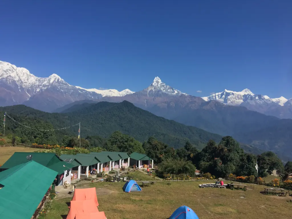
One of the most rewarding short hikes near Pokhara, the trail to Australian Camp begins at Phedi village and climbs steadily through rhododendron forests, terraced farms, and traditional Gurung settlements. The reward at the top is extraordinary: a sweeping panorama of the Annapurna massif including Machapuchare (Fishtail Mountain), Hiunchuli, and Annapurna South, especially breathtaking at sunrise when the peaks glow pink above the clouds.
The trail is well-maintained, clearly marked, and lined with teahouses where you can rest with a cup of masala tea. This is an ideal first Himalayan hiking experience for families, first-timers, and those short on time. Many hikers combine it with nearby Pothana village for a longer loop.
Local Tip: Stay the night at Australian Camp for an unforgettable sunrise over Annapurna. The camp has comfortable tea houses and the pre-dawn light show is worth every extra hour.
Dhampus Village Hike
Difficulty: Easy Location: Annapurna Foothills, near Pokhara Distance: 6–8 km Duration: 2–4 hours Max Altitude: 1,650m
Dhampus is a traditional Gurung village perched on a hillside above Pokhara, offering a beautiful combination of cultural walking and mountain scenery. The trail winds through stone-paved lanes, past slate-roofed homes, communal water spouts, and small gompa (Buddhist monasteries). The Gurung people are known for their warmth and many families open their homes to visitors.
The Annapurna range fills the northern horizon on clear days, creating stunning backdrops for photography. This easy trail is suitable for children and seniors, making it one of Nepal’s best family hiking options. It pairs perfectly with a visit to the World Peace Pagoda above Pokhara.
Shivapuri National Park Day Hike
Difficulty: Easy Location: North Kathmandu (10 km from Thamel) Distance: 8–16 km (various route options) Duration: 3–6 hours Max Altitude: 2,732m (Shivapuri Peak summit)
Shivapuri Nagarjun National Park is Kathmandu Valley’s most accessible wilderness escape, a protected forest zone just 10 km from Thamel. Dense oak, rhododendron, and pine forest provide a cool, serene environment year-round, making this an excellent hike for those arriving or departing Kathmandu with a spare day.
Trails vary from easy forest walks to the summit of Shivapuri Peak (2,732m), which offers sweeping views of the entire Kathmandu Valley and the Himalayan horizon on clear days. The park hosts over 300 recorded bird species, making it one of the best birdwatching areas near the capital. The revered Nagi Gompa monastery near the summit adds a meaningful cultural dimension to the hike.
Practical Note: A park entry ticket is required (NPR 500 for foreign visitors). Carry all the water you need, shops are limited inside the park boundary..
Nagarkot to Changu Narayan Ridge Walk
Difficulty: Easy to Moderate Location: Kathmandu Valley Rim Distance: 14–16 km one-way Duration: 5–7 hours Start Altitude: 2,175m
The Nagarkot to Changu Narayan ridge walk is arguably the finest Himalayan panorama hike accessible from Kathmandu within a single day. The trail begins at Nagarkot’s famous viewpoint, one of the best spots in Nepal to see a 180° sweep of peaks from Dhaulagiri to Everest, and follows the valley rim through forests, farming villages, and open ridgelines.
The destination, Changu Narayan Temple, is a UNESCO World Heritage Site and one of Nepal’s oldest surviving temples, dating to the 4th century CE. This makes the hike a compelling blend of Himalayan panorama and living cultural heritage. A local vehicle can collect you at Changu Narayan for the return to Kathmandu, completing a satisfying point-to-point adventure.
Moderate Hiking Places in Nepal
These hikes require reasonable fitness and span multiple days. Teahouse accommodation is available throughout, and altitude ranges from 2,500–3,500m. Expect 5–7 hours of hiking per day on hilly terrain.
Ghorepani Poon Hill Trek
Difficulty: Moderate Location: Annapurna Region Duration: 4–5 days round trip Daily Hiking: 5–7 hours Max Altitude: 3,210m
The Ghorepani Poon Hill trek is the most popular short hike in Nepal, and for very good reason. This 4–5 day loop from Nayapul near Pokhara delivers one of the most celebrated sunrise panoramas in the Himalayas. From Poon Hill viewpoint (3,210m), you watch golden light illuminate a panorama of 12+ peaks including Dhaulagiri, Annapurna I, Annapurna South, Machapuchare, Nilgiri, and Hiunchuli.
The trail passes through Ghorepani, a high-altitude Magar village, and on to the enchanting rhododendron forests between Ghorepani and Tadapani that blaze crimson and pink in spring. Teahouse accommodation is excellent throughout, making this an ideal first multi-day hiking experience. Fitness requirement is moderate, expect long uphill days, but nothing technically demanding.
Best Season: March–April (rhododendrons in bloom) and October–November (clearest skies) are peak times, but this trail is hikeable nearly year-round.
Difficulty: Moderate Location: Pokhara Region Duration: 2–3 days Daily Hiking: 4–6 hours Max Altitude: 2,517m
Panchase Hill is one of Nepal’s most underrated short treks, a quiet, forested alternative to the famous Poon Hill route that offers comparable Annapurna views without the crowds. The trail winds through one of the densest rhododendron forests in the Pokhara region, with over 40 species of rhododendrons recorded on the slopes.
From the Panchase viewpoint, you enjoy a clear line-of-sight to Annapurna South, Hiunchuli, Machapuchare, and the glittering Phewa Lake below Pokhara. The hike starts and ends near the lakeshore, making it easy to combine with a day in Pokhara. Excellent for travelers seeking solitude, photography, or a nature-focused experience away from the busier routes.
Langtang Valley Hike
Difficulty: Moderate to Challenging Location: Langtang Region Duration: 7–10 days Daily Hiking: 5–8 hours Max Altitude: 3,870m (Kyanjin Gompa)
The Langtang Valley is Nepal’s most accessible mountain valley hike from Kathmandu, just 3 hours by jeep to the trailhead at Syabrubesi. The valley is framed by the dramatic wall of Langtang Lirung (7,234m) and filled with high pastures, glaciers, yak herds, and Tamang villages. It’s one of the few hikes in Nepal where the journey into the mountains feels genuinely wild and remote.
Beyond Langtang village, the trail climbs to Kyanjin Gompa (3,870m), a cluster of stone buildings including an ancient monastery and a local yak cheese factory. Ambitious hikers can scramble to Kyanjin Ri or Tsergo Ri for extraordinary 360° panoramas of the Langtang massif.
Expert Note: Langtang hosts a unique Tamang culture of Tibetan origin. Their traditions, cuisine (particularly thukpa noodle soup and yak butter tea), and gompa architecture are distinct from other Himalayan regions. The valley was heavily affected by the 2015 earthquake, hiking in Nepal supports rebuilt local communities directly.
Difficulty: Moderate Location: Near Kathmandu Duration: 5–7 days loop Daily Hiking: 5–7 hours Max Altitude: 3,650m
The Helambu trek offers an excellent multi-day hiking experience within two hours of Kathmandu, making it ideal for travelers with limited time or those combining hiking with city sightseeing. The circuit passes through Hyolmo (Yolmo) Sherpa villages characterized by intricately painted monasteries, prayer wheel paths, and traditional farmhouses decorated with Buddhist symbols.
The landscapes range from subtropical forests in the lower valleys to open alpine ridges with views of Langtang, Jugal Himal, and on clear days, even the Everest range. This is a culturally rich, less-crowded alternative to the Annapurna and Everest regions, one that rewards hikers interested in Buddhist heritage and mountain community life equally.
These are serious multi-day hikes at high altitude requiring good fitness, proper acclimatization, and ideally a licensed local guide. Altitude ranges from 3,500–5,500m. Helicopter evacuation travel insurance is essential.
Annapurna Base Camp (ABC)
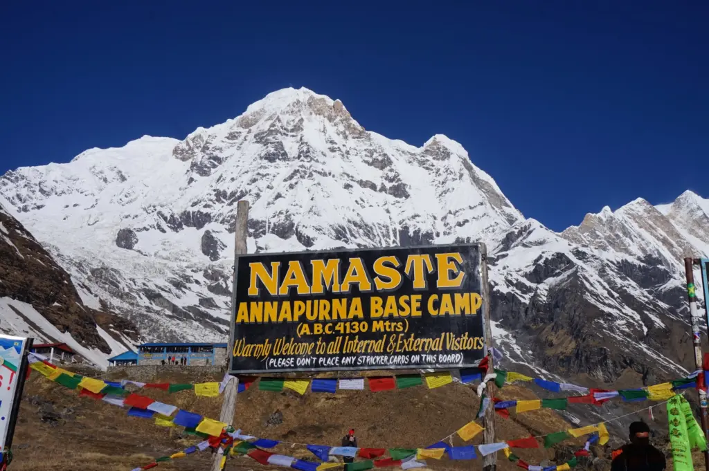
Difficulty: Challenging Location: Annapurna Region Duration: 10–14 days round trip Daily Hiking: 6–8 hours Max Altitude: 4,130m
The Annapurna Base Camp trek is one of the world’s great mountain experiences, a journey through the Modi Khola gorge into the extraordinary Annapurna Sanctuary, a natural amphitheater surrounded by 360° Himalayan walls. At base camp, you stand surrounded by Annapurna I (the world’s 10th highest peak), Annapurna South, Machapuchare, Hiunchuli, and Gangapurna, all within breathtaking proximity.
The route from Nayapul passes through the Modi Khola valley, the rhododendron forests of Chomrong, and the Modi Khola gorge, one of the deepest river gorges in the world. The final approach to base camp crosses open glacial moraines with extraordinary close-up views of the South Face of Annapurna. This is a physically demanding but non-technical hike accessible to fit hikers without mountaineering experience.
Planning Note: The Annapurna Conservation Area Permit (ACAP) and TIMS card are both required. Teahouse accommodation is available throughout. The gorge section is susceptible to avalanche in heavy snowfall, always hike with a licensed local guide.
Difficulty: Challenging Location: Khumbu / Everest Region Duration: 7–10 days Daily Hiking: 5–7 hours Max Altitude: 3,880m (Namche Bazaar area)
The Everest View Trek brings you face-to-face with Sagarmatha (Mt. Everest, 8,849m) without committing to the full Everest Base Camp route. Flying into Lukla (2,860m) and hiking through Phakding, Namche Bazaar, and Tengboche to the Hotel Everest View (3,880m), you achieve unobstructed views of the world’s highest peak alongside Lhotse, Nuptse, Ama Dablam, and dozens of other giants.
The Khumbu valley is also one of the most culturally rich areas of Nepal, home to the Sherpa people, whose monasteries, mani walls, stupas, and mountaineering heritage permeate every village. Namche Bazaar, the main Sherpa trading hub, has excellent cafes, a fascinating mountaineering museum, and a weekend market. Acclimatization days in Namche are essential; this trek demands patience as much as physical fitness.
Difficulty: Challenging Location: Annapurna Region Duration: 5–7 days Daily Hiking: 5–8 hours Max Altitude: 4,500m
Mardi Himal Trek is Nepal’s most exciting off-the-beaten-path short high-altitude hike. The trail runs along a dramatic, narrow ridge overlooking the Modi Khola valley with jaw-dropping views of Machapuchare (Fishtail Mountain), the sacred peak that has never been climbed, at seemingly arm’s length. Mardi Himal Base Camp at 4,500m sits directly below the summit snows of Machapuchare, creating one of the most intimate mountain viewpoints in the entire Annapurna region.
The ridge route passes through dense rhododendron forests in the lower sections, emerges above the treeline into yak pastures, and narrows to exposed ridgeline as you gain altitude. The reward, solitude, scenery, and the feeling of genuinely exploring a less-traveled Himalayan trail is exceptional.
Difficulty: Challenging Location: Annapurna South Region Duration: 7–10 days Daily Hiking: 6–8 hours Max Altitude: 4,740m
Khopra Danda (also called Khopra Ridge) is among the finest off-beat treks in the Annapurna region, a community-managed hiking route that takes you to a high ridge between Dhaulagiri and Annapurna with extraordinary views of both massifs simultaneously. At 4,740m, the Khopra Danda community lodge sits at the junction of two of the world’s greatest mountain ranges, offering a panorama very few trekkers ever see.
The optional extension to Khayer Lake (4,700m), a sacred glacial lake used for Hindu pilgrimage, adds a deeply spiritual and visually stunning dimension to this hike. All accommodation on this route is managed by local community lodges, meaning your hiking fees directly support Himalayan village economies.
Nepal’s hiking geography divides into several distinct regions, each with its own character, culture, and mountain scenery. Understanding these regions helps you match your interests to the right part of the country.
Annapurna Region:Nepal’s most popular hiking region, offering extraordinary variety, from easy village hikes to high-altitude base camps. The best teahouse infrastructure in the country. Accessible from Pokhara within 1–2 hours.
Everest / Khumbu Region: Home of Sherpa culture and the world’s highest peak. Dramatic high-altitude terrain, culturally rich villages, legendary mountain views, and a mountaineering heritage unlike anywhere else on Earth.
Langtang Region: The closest Himalayan valley to Kathmandu. Tibetan Buddhist culture, glaciers, yak pastures, and excellent birdwatching in pristine forests. Ideal for Kathmandu-based travelers.
Kathmandu Valley: Day hikes through UNESCO heritage villages, forest reserves, and ridgelines with Himalayan panoramas. Perfect for short layover hikes of 4–8 hours without leaving the valley.
Eastern Hills & Ilam: Nepal’s most overlooked region, tea gardens, rhododendron forests, and views of Kanchenjunga (the world’s 3rd highest peak) without the Everest crowds.
Best Time for Hiking in Nepal
Unlike many mountain destinations, Nepal offers good hiking conditions throughout the year. Each season brings different experiences, trail conditions, and crowd levels. Here are the best seasons to hike in Nepal:
Spring (March–May): The best overall season for most hikes. Rhododendron forests blaze with color. Stable weather, excellent visibility, and long daylight hours. Most popular season, book accommodation and guides in advance. Temperatures warm quickly at altitude from April onward.
Autumn (September–November): The premier trekking season. Post-monsoon skies are crystal clear with outstanding mountain visibility. Cool, stable temperatures and trails freshly washed green by the monsoon. September–October is the peak window for serious high-altitude hikes.
Winter (December–February):Best for low-altitude hikes. High passes may close with snow, but lower trails near Pokhara and Kathmandu remain excellent. Fewer crowds, lower teahouse prices, and crisp clear days with exceptional mountain views on sunny mornings.
Monsoon (June–August):Best for lush greenery and solitude. Rain brings impossibly green hillsides and dramatic waterfalls. Higher trails remain viable in rain shadow regions like Mustang and Dolpo. Leeches are present on lower jungle trails, pack gaiters and salt accordingly.
Expert Recommendation: For a first hiking trip to Nepal, aim for October–November (best clarity) or late March–April (best color). These windows combine stable weather, open trails, and the most dramatic mountain visibility of the year.
Permits & Entry Requirements for Nepal Hiking
Most hiking areas in Nepal require one or more permits. Knowing what you need before arriving saves time and avoids being turned away at trail checkpoints.
TIMS Card: Required for most trekking areas. Cost: USD 10–20. Available at TAAN offices in Kathmandu or Pokhara.
ACAP Permit (Annapurna Conservation Area): Required for all Annapurna region hikes. Cost: NPR 3,000 (~USD 23). Available at NTNC offices or online.
Sagarmatha National Park Entry: Required for Everest region hikes. Cost: NPR 3,000 (~USD 23). Collected at the entry checkpoint at Monjo.
Langtang National Park Entry: Required for Langtang region hikes. Cost: NPR 3,000 (~USD 23). Collected at Syabrubesi checkpoint.
Shivapuri National Park Entry: Required for Shivapuri day hikes. Cost: NPR 500 (~USD 4). Collected at the park entry gate.
Special Area Permit: Permit required for Manaslu, Tsum Valley, and Dolpo. Cost: USD 70–100+ per week depending on season. Must be arranged through a registered agency in Kathmandu.
Important note: Permit requirements and fees are updated by the Nepal government annually. Your guide or local trekking agency will always have the most current information. Since 2023, hiring a licensed guide is legally mandatory for trekking in several areas including the Annapurna and Everest circuits.
Tips for Hiking in Nepal
Altitude Awareness: Above 3,000m, ascend slowly, no more than 300–500m per day once past this threshold. Recognize the symptoms of Acute Mountain Sickness (AMS): persistent headache, nausea, dizziness, and loss of appetite. Descend immediately if symptoms worsen. Never ascend with AMS symptoms present.
Guides vs. Solo Hiking: A licensed local guide dramatically improves your experience, they navigate, handle permits, translate, and provide vital safety backup. For trails above 3,000m or in remote regions, a guide is strongly recommended. For easy day hikes near Pokhara, fit and experienced solo hiking is viable with proper maps and preparation.
Essential Gear: Pack layered clothing (temperatures swing 20°C between valley and ridge), a waterproof jacket, broken-in hiking boots with ankle support, trekking poles (invaluable on steep descents), UV protection sunscreen and sunglasses, water purification tablets or a filter, and a basic first aid kit including blister care.
Permits & Travel Insurance: Secure all required permits before hitting the trail. Travel insurance with helicopter evacuation cover is essential for any hike above 3,000m. Rescue costs without insurance can exceed USD 5,000.
Fitness Preparation: For moderate and challenging hikes, begin cardiovascular training at least 6–8 weeks before your trip. Walking, running, and cycling all help. Building stair-climbing into your daily routine is the most effective Nepal-specific preparation, strong legs mean happy knees on long descents.
Hydration and Food: Drink 3–4 liters of water daily at altitude, dehydration accelerates altitude sickness significantly. Dal bhat (lentil rice with vegetables and curry) is the ideal trail food: high energy, available everywhere on major trails, and nutritionally complete. Eat plenty of carbohydrates at altitude.
Connectivity and Communication: Nepal Telecom and Ncell SIM cards work on major trails up to roughly 3,500m. Above that, connectivity becomes unreliable. Download offline maps (Maps.me or Gaia GPS) before departing your base. For remote high-altitude routes, consider renting a satellite communicator.
Leave No Trace: Nepal’s mountain ecosystems are fragile. Carry out all plastic waste, use established toilet facilities at teahouses, stay on marked trails to prevent erosion, and avoid picking wildflowers or disturbing wildlife.
Plan Your Hiking Adventure in Nepal
Whether you want a two-hour sunrise walk above Pokhara or a ten-day high-altitude ridge expedition in the Annapurna Sanctuary, our local experts are ready to build the perfect Nepal hiking trip around your time, fitness, and interests.
We offer:
Custom-designed hikes for any duration and difficulty level
Day hikes from Pokhara and Kathmandu with no advance booking required
Short 2–5 day treks with all teahouse accommodation arranged
Licensed, English-speaking local guides with first-aid training
All permit procurement and logistics handled on your behalf
Small private groups for a personalized mountain experience
Frequently Asked Questions About Hiking in Nepal
Do I need a guide for hiking in Nepal?
For easy day hikes near Pokhara and Kathmandu, experienced hikers can manage independently with a good map. For moderate and challenging hikes above 3,000m, a licensed local guide is strongly recommended. Guides provide navigation, emergency medical support, cultural context, and permit management. Since 2023, guides are legally required for certain trekking areas including the Annapurna and Everest circuits.
How fit do I need to be for hiking in Nepal?
Easy trails require no special fitness, if you walk regularly, you’ll manage fine. Moderate hikes like Poon Hill require you to comfortably walk 5–6 hours per day over hilly terrain. Challenging hikes like Annapurna Base Camp or Everest View demand a solid cardio base built over at least 6–8 weeks of preparation. Altitude, not distance, is the primary challenge. Your body’s acclimatization capacity matters more than your walking speed.
What is the best time of year to hike in Nepal?
October–November offers the clearest mountain views and most stable weather, making it the optimal choice for high-altitude hikes. March–May is the second peak season, famous for rhododendron blooms throughout the trail forests. Low-altitude hikes near Pokhara and Kathmandu are viable in all seasons, including winter and monsoon.
How much does hiking in Nepal cost?
Budget hiking can cost as little as USD 25–40 per day including accommodation, meals, and a guide on simpler routes. Guided day hikes near Pokhara typically cost USD 50–100 with a local company. Multi-day guided hikes like Poon Hill range from USD 300–600 total. Challenging hikes like Annapurna Base Camp or Everest View run USD 800–1,500 with guide, permits, and teahouse accommodation included.
Is hiking in Nepal safe?
Nepal’s major hiking trails are generally very safe when approached with proper preparation. The primary risks are altitude sickness (manageable with slow ascent), trail injuries (minimized with proper footwear and trekking poles), and weather changes (managed with layered clothing). Hiring a licensed guide, purchasing helicopter evacuation insurance, and informing your guesthouse of your daily route are the three most important safety practices.
Can I hike in Nepal as a complete beginner?
Absolutely. Australian Camp, Dhampus, Shivapuri, and the Nagarkot to Changu Narayan trail are all designed for first-timers and require no previous hiking experience. These trails have clear paths, teahouse rest stops, and manageable elevation gains. They deliver an authentic Nepal mountain experience within hours of arriving in Pokhara or Kathmandu.
If you’re dreaming of a true Himalayan adventure filled with raw wilderness, towering snow-covered peaks, and a thrilling high-altitude crossing, Larkya La Pass deserves a top spot on your trekking bucket list. Larkya La Pass (also spelled Larke Pass or Larkya La) is a spectacular high-altitude mountain pass located in the remote Manaslu region of Nepal. It is the highest and most dramatic point of the renowned Manaslu Circuit Trek, with the Larkya Pass height standing at approximately 5,106 to 5,160 meters (16,752 to 16,929 feet) above sea level.
The Larkya La Pass trek is famous for its remote trails, authentic mountain villages, and panoramic views of giants like Himlung Himal, Cheo Himal, Kang Guru, and Annapurna II. Compared to busier routes, the Manaslu Circuit remains refreshingly uncrowded, making the journey across Larke Pass feel like a genuine expedition rather than a tourist trek.
This in-depth guide covers everything you need to know about Larkya La Pass, including altitude, difficulty level, best trekking season, detailed itinerary, permits, packing essentials, and crucial safety tips. Whether you’re an experienced trekker or planning your first major high-pass crossing, this guide will help you prepare confidently and make the Manaslu Circuit Larkya La Pass trek one of the most unforgettable adventures of your life.
Where Is Larkya La Pass?
Larkya La Pass lies between Dharamsala (Larke Phedi) and Bimthang, connecting the Manaslu region with the Annapurna range in west‑central Nepal.
Region: Manaslu Conservation Area
Trek: Manaslu Circuit Trek
Elevation: 5,160 m / 16,930 ft
Nearest village: Samdo (before the pass), Bimthang (after)
The pass offers panoramic views of Himlung Himal, Cheo Himal, Kang Guru, and Annapurna II, making it one of Nepal’s most rewarding crossings.
Why Larkya La Pass Is So Special?
What truly sets Larke Pass apart is its sense of remoteness and raw Himalayan beauty. Unlike heavily trafficked high passes such as Thorong La, the Larkya La Pass trek feels wild, peaceful, and wonderfully untouched. As part of the Manaslu Circuit Larkya Pass route, the trail takes you far from roads and crowds, deep into a landscape shaped by glaciers, high mountains, and centuries-old traditions.
Along the way, you’ll pass through Tibetan-influenced villages, prayer-flag-lined trails, ancient monasteries, and dramatic glacial valleys. The journey across Larkya La Pass is not just a physical challenge, it’s a cultural and visual immersion into one of Nepal’s most authentic trekking regions.
Highlights of Larke Pass
Vast glacier crossings and rugged high-altitude terrain
Jaw-dropping Himalayan amphitheater views from the pass
Rich Tibetan culture, traditions, and monasteries
A genuine high-altitude adventure that feels like a true expedition
Crossing Larkya La Pass is often the defining moment of the Manaslu Circuit, an unforgettable blend of solitude, scenery, and achievement that stays with trekkers long after the journey ends.
How Difficult Is Larkya La Pass?
The Larkya La Pass difficulty is generally rated as moderate to challenging, making it one of the more demanding but rewarding high passes in Nepal. While the Larkya La Pass trek does not require technical climbing or mountaineering skills, it does test your endurance, preparation, and ability to handle high altitude.
Sitting at a Larke La Pass altitude of 5,160 meters, the pass pushes trekkers well above the 5,000-meter mark, where oxygen levels are significantly lower. Proper acclimatization and a steady trekking pace are essential for a safe and successful crossing.
What Makes Larkya La Pass Challenging?
High altitude: The thin air above 5,000 m is the biggest challenge of the Larkya La Pass trek
Long crossing day: Expect an 8–10 hour trek from Dharamsala to Bimthang
Snow and ice: Common in early spring and late autumn, adding difficulty to the trail
Cold and windy conditions: Especially intense near the summit of Larke Pass
Physical and mental endurance: Sustained uphill sections require stamina and focus
Despite these challenges, the Manaslu Circuit Larkya La Pass route is very achievable for well-prepared trekkers. If you’ve previously completed treks such as Everest Base Camp or the Annapurna Circuit, you’ll likely find the Larkya La Pass difficulty manageable with proper training, acclimatization days, and realistic expectations.
With the right preparation, crossing Larkya La Pass becomes less about difficulty, and more about the incredible sense of accomplishment that comes with standing atop one of Nepal’s most spectacular Himalayan passes.
Best Time For Larkya La Pass
Choosing the best time to cross Larke Pass is crucial for safety, trail conditions, and mountain views. Due to its high altitude and exposed terrain, the Larkya La Pass trek is highly seasonal, and timing can make or break the experience.
Best Seasons for Larkya La Pass Trek
Spring (March–May)
Spring is one of the most popular and reliable seasons for the Manaslu Circuit Larkya La crossing.
Stable weather and improving temperatures
Blooming rhododendron forests at lower elevations
Clear views of snow-covered Himalayan peaks
Manageable snow conditions near larke pass altitude
Autumn (September–November)
Autumn is widely considered the best season to cross Larke Pass.
Excellent visibility and crisp mountain air
Dry, well-defined trails across the Manaslu Circuit
Ideal daytime temperatures for high-altitude trekking
Consistently safe conditions at Larkya La Pass altitude
Seasons to Avoid
Winter (December–February)
Winter trekking across Larkya La Pass is strongly discouraged.
Heavy snowfall often blocks the pass
Extreme cold and high winds at 5,160 meters
Limited teahouse availability and increased risk
Monsoon (June–August)
The monsoon season makes the Larkya La Pass trek unpredictable.
For the safest crossing and the most spectacular views, plan your Larkya La Pass trek in spring or autumn. These seasons offer the perfect balance of weather stability, trail safety, and breathtaking Himalayan scenery, ensuring your Manaslu Circuit Larkya La Pass experience is both safe and unforgettable.
Note: The itinerary days may vary depending on weather conditions, acclimatization needs, and individual trekking pace.
For detailed information on permits, itinerary, costs, and trip options, explore our complete
Manaslu Circuit Trek guide.
Permits Required for Larkya La Pass
Because the Larke Pass trek runs through a restricted region of the Manaslu Himal, permits are mandatory for all trekkers. These permits are required to legally complete the Manaslu Circuit Larkya La crossing.
Required Permits and Prices
Manaslu Restricted Area Permit (RAP)
September–November: USD 100 per person (first 7 days) + USD 15 per extra day
December–August: USD 75 per person (first 7 days) + USD 10 per extra day
Manaslu Conservation Area Permit (MCAP)
NPR 3,000 per person
Annapurna Conservation Area Permit (ACAP)
NPR 3,000 per person
These permits are checked multiple times along the Larkya La Pass route, especially before and after the high-pass crossing.
Important Rules to Know
Trekking without a licensed guide is strictly not allowed on the Manaslu Circuit, enforced year-round including monsoon
You must trek with a licensed, government-registered guide from a registered Nepalese agency at all times
One licensed guide may accompany a maximum of 7 trekkers per group, larger groups must arrange an additional guide
Individual solo foreign tourists can now obtain the Manaslu RAP through a registered trekking agency, no minimum group size required (effective March 22, 2026)
Permits can now be applied for digitally from abroad using your Visa Application Submission ID, your agency can process this before you arrive in Nepal
All permits must be arranged through a registered trekking agency, self-application is not permitted
All permits are usually arranged through a registered trekking agency, making the process straightforward when booking a guided Larkya La Pass trek.
Accommodation and Food on the Manaslu Circuit
Accommodation on the Larkya La Pass trek is provided through traditional teahouses along the Manaslu Circuit. While facilities are simple, they are warm, welcoming, and perfectly suited for high-altitude trekking.
Teahouses are available in all major villages on the Manaslu Circuit Larkya La route
Rooms are basic but cozy, usually with twin beds and blankets
Meals commonly include dal bhat, noodles, soups, fried rice, pancakes, Tibetan bread, and momos
Menu options become more limited above Samdo due to altitude and supply constraints
Electricity and Wi-Fi are scarce at higher elevations, especially near Larkya La Pass altitude, making this trek a perfect digital detox
Food is hearty and carb-rich, ideal for maintaining energy during long trekking days and the demanding Larkya La Pass crossing.
What to Pack for Larkya La Pass?
Packing correctly is essential for a safe and comfortable Larkya La Pass trek, especially given the cold temperatures and high altitude.
Essential Gear for Larkya La Pass
Down jacket rated to −15°C or colder
Thermal base layers (top and bottom)
Waterproof jacket and pants (windproof preferred)
Insulated gloves and warm beanie
High-ankle trekking boots with good grip
Trekking poles (very helpful on the Larkya La Pass descent)
UV-protected sunglasses and high-SPF sunscreen
Safety & Health Items
Diamox for altitude sickness (consult your doctor first)
Personal first-aid kit
Headlamp or torch with spare batteries
Water purification tablets or filter
A well-planned packing list for Larkya La Pass can make the difference between an exhausting trek and an enjoyable high-altitude adventure, especially on the long summit day across the Manaslu Circuit Larkya La Pass.
Altitude Sickness and Safety Tips for Larkya La Pass
At the Larkya Pass altitude of 5,160 meters, trekkers are well above the elevation where Acute Mountain Sickness (AMS) commonly occurs. Managing altitude properly is one of the most important aspects of a safe and successful Larkya La Pass trek.
How to Stay Safe on the Larkya La Pass Trek
Take acclimatization days seriously, especially in Samagaun, to allow your body to adjust to the altitude
Drink 3–4 liters of water daily to stay hydrated at high elevation
Ascend slowly and steadily, following your guide’s pacing recommendations
Avoid alcohol and smoking, which increase the risk of altitude sickness
Listen to your licensed guide, who is trained to recognize early AMS symptoms
Important Safety Warning
If symptoms of altitude sickness on Larkya La Pass, such as headache, nausea, dizziness, or shortness of breath, worsen or do not improve with rest, immediate descent is the safest and most effective treatment.
With proper acclimatization, hydration, and guidance, crossing Larke Pass as part of the Manaslu Circuit trek can be both safe and deeply rewarding.
Larkya La Pass vs Thorong La Pass
Feature
Larkya La Pass
Thorong La Pass
Altitude
5,160 m
5,416 m
Crowds
Low – remote and peaceful
Very high – popular and busy
Scenery
Wild, untouched Himalayan landscapes
Dramatic mountain views but crowded
Culture
Tibetan-influenced villages and monasteries
Mixed cultures along the trail
Trek Style
Off-the-beaten-path adventure
Classic, well-trodden route
If you want to see how Larkya La Pass compares to its famous counterpart, explore our full guide on
Thorong La Pass Annapurna Circuit for insights, tips, and photos.
Is Larkya La Pass Worth It?
Absolutely, without question. If you’re searching for a high Himalayan pass that blends solitude, rich culture, and jaw-dropping mountain scenery, Larkya La Pass delivers on every level. As the highest point of the Manaslu Circuit Larkya Pass route, it offers a rare sense of wilderness that’s increasingly hard to find in Nepal’s more commercial trekking regions.
The Larkya La Pass trek is challenging enough to feel like a genuine accomplishment, yet completely achievable for trekkers who prepare properly, acclimatize well, and respect the altitude.
The reward? Standing at 5,160 meters, surrounded by an amphitheater of Himalayan giants, knowing you’ve crossed one of Nepal’s most spectacular high passes.
Final Thoughts
Crossing Larkya La Pass is more than just completing a trek, it’s a journey through one of Nepal’s last truly unspoiled mountain regions. From Tibetan-influenced villages and ancient monasteries to vast glacier-carved valleys and remote alpine landscapes, every step along the Manaslu Circuit feels meaningful and earned.
If you’re looking for a Himalayan adventure that is authentic, adventurous, and unforgettable, the Manaslu Circuit Larkya La Pass trek deserves a top place on your bucket list. This is the kind of journey that stays with you long after the trail ends.
The pass stands at approximately 5,106–5,160 meters (16,752–16,930 ft) above sea level, making it one of the highest trekking passes in Nepal.
How difficult is the Larkya La Pass trek?
It’s considered moderate to challenging due to its high altitude, long trekking day, and steep sections. Fitness, good acclimatization, and trekking experience improve success.
What is the Larkya Pass height?
The Larkya Pass height is approximately 5,106 to 5,160 meters (16,752 to 16,929 feet) above sea level.
Yes, Larkya La Pass lies in a restricted area of Nepal, so all trekkers must be accompanied by a licensed guide and be in a group of at least two people.
What permits are required for Larkya La Pass?
You must have: – Manaslu Restricted Area Permit (RAP) – Manaslu Conservation Area Permit (MCAP) – Annapurna Conservation Area Permit (ACAP) These help fund conservation and ensure safety.
Is it dangerous to cross Larkya La Pass?
It isn’t technically dangerous if you are well prepared, but altitude sickness, weather, and exhaustion are real risks at high elevation. Proper acclimatization is essential.
Are there amenities like Wi‑Fi or ATMs along the route?
Mobile signal and Wi‑Fi are limited after lower villages; there are no ATMs on the trail, so carry enough cash from Kathmandu.
Can beginners do Larkya La Pass?
It’s not recommended for absolute beginners due to altitude and physical demands, but those who prepare physically and understand acclimatization can complete it successfully.
Are you dreaming of trekking through one of Nepal’s most remote and breathtaking Himalayan circuits? The Manaslu Circuit Trek offers an unforgettable adventure around Mt. Manaslu, the eighth-highest mountain in the world at 8,163 meters, with far fewer crowds than the popular Everest Base Camp or Annapurna Circuit routes. But before lacing up your boots, the most important question every trekker asks is: How much does the Manaslu Circuit Trek cost?
This comprehensive guide breaks down every expense you can expect, from permits and guide fees to food, accommodation, and transport, so you can plan your Manaslu adventure with confidence and zero financial surprises.
Overview: How Much Does the Manaslu Circuit Trek Cost?
The Manaslu Circuit Trek cost in 2026/2027 ranges from approximately USD 900 to USD 2,500 per person, depending on the type of package, group size, season, and level of comfort. For a standard 14–16 day all-inclusive trekking package, most trekkers can expect to budget between USD 1,200 and USD 1,900 per person. Budget group-joining treks start from around USD 950–1,200, while private packages typically run USD 1,500–2,200.
Here is a quick cost summary at a glance:
Budget group trek
USD 950 – 1,200 per person
Standard package
USD 1,200 – 1,900 per person
Private luxury trek
USD 2,000 – 2,500+ per person
Trek duration
14–16 days (excluding Kathmandu stay)
1. Manaslu Circuit Trek Permit Costs
The Manaslu region is a restricted trekking area, which means obtaining the right permits is mandatory, and non-negotiable. All Manalsu Circuit Trek permits must be arranged through a registered trekking agency. As of March 22, 2026, individual solo foreign tourists are now permitted to obtain the Restricted Area Permit, however, a licensed Nepali guide remains mandatory at all times. One guide may accompany a maximum of 7 trekkers per group
a) Manaslu Restricted Area Permit (MRAP)
This is the most critical and expensive permit for the trek. The cost varies by season:
Peak Season (September to November): USD 100 per person for the first 7 days, then USD 15 per additional day
Off-Season (December to August): USD 75 per person for the first 7 days, then USD 10 per additional day
b) Manaslu Conservation Area Permit (MCAP)
This permit promotes conservation and biodiversity in the Manaslu region. Cost: NPR 3,000 (approximately USD 25) per person.
c) Annapurna Conservation Area Permit (ACAP)
Required because the Manaslu Circuit trail connects with the Annapurna region near Dharapani or Besisahar at its conclusion. Cost: NPR 3,000 (approximately USD 25) per person.
d) Chumnubri Rural Municipality Permit
An additional local permit required for trekking through certain villages in the circuit. Cost: approximately USD 10 per person.
Total Estimated Manaslu Circuit Permit Cost: USD 160 – 200 per person (peak season)
New (March 22, 2026): Trekkers can now apply for the Restricted Area Permit digitally from their home country using their Visa Application Submission ID, before arriving in Nepal. Your registered trekking agency can initiate this process on your behalf as soon as your booking is confirmed.
Note: If you plan to visit Tsum Valley as an
extension, an additional Tsum Valley Permit is required,
USD 40 per person for the first 7 days (peak season), then
USD 7 per additional day.
2. Guide and Porter Costs
Hiring a licensed guide is mandatory as per Nepal government regulations introduced in April 2023. Beyond being a legal requirement, a knowledgeable guide enriches your experience with cultural insights, local knowledge, and logistical support.
Licensed Trekking Guide
Standard English-speaking guide: USD 25 – 40 per day
Highly experienced senior guide: up to USD 50 per day
Porter
Standard porter (carries up to 20 kg): USD 20 – 30 per day
Guide-porter (one person serving both roles): USD 25 – 30 per day
For a 14-day trek with one guide and one porter, you should budget approximately USD 630, 1,120 for guide and porter services combined, including their meals and accommodation (which trekking agencies typically cover).
Note: As per the updated DoI regulations effective March 22, 2026, one licensed guide may accompany a maximum of 7 trekkers. Groups larger than 7 must arrange an additional licensed guide, which will affect the overall guide cost.
3. Transportation Costs
The Manaslu Circuit Trek typically begins at Sotikhola or Machha Khola, which is about 160 km northwest of Kathmandu. There are no direct flights to the trailhead, so all transportation is by road.
Kathmandu to Trailhead
Public bus (local): USD 10 – 15 per person (8–9 hour journey, budget-friendly but less comfortable)
Private jeep: USD 200 – 350 per vehicle (faster and more comfortable, ideal for small groups)
Return Journey (Dharapani/Besisahar to Kathmandu)
Shared jeep/bus: USD 15 – 30 per person
Private jeep: USD 180 – 300 per vehicle
Most standard trekking packages include round-trip public bus transportation in the cost. If you prefer a jeep for comfort, this will be an additional charge. It is recommended to book private jeeps in advance through your trekking agency.
4. Food and Meal Costs
During the Manaslu Circuit Trek, all meals are prepared fresh in local teahouses and lodges. The food options are hearty and nourishing, with the classic Nepali dal bhat being both the most popular and the best value for money on the trail.
Dal Bhat (staple Nepali meal with rice, lentils, vegetables, and pickles): USD 5 – 10 per meal
Snacks and hot drinks throughout the day: USD 2 – 5
Daily food budget estimate: USD 20 – 40 per person per day
Important note: Food prices increase significantly at higher
altitudes due to the difficulty of transporting supplies into remote mountain
areas. Budget more per day as you gain elevation, especially around
Samagaun and Samdo.
5. Accommodation Costs
Accommodation along the Manaslu Circuit is provided by locally-owned teahouses and mountain lodges. While luxury is not on the menu here, the teahouses are comfortable and cozy enough for a good night’s rest after a long day of trekking.
Basic teahouse/lodge room (twin sharing): NPR 500 – 1,500 per night (approximately USD 4 – 12)
Better facilities at lower elevations:USD 5 – 15 per night
Higher altitude lodges: prices tend to increase due to remoteness
Most trekking packages include accommodation for the entire duration of the trek. If you are trekking independently, budget around USD 4 – 15 per night. Many teahouses offer free or discounted rooms when you dine at their establishment.
6. Travel Insurance Costs
Travel insurance is absolutely essential for the Manaslu Circuit Trek, and in practice, most trekking agencies require proof of insurance before confirming your booking. Given the remote nature of the trek and the altitude involved, your policy must cover high-altitude helicopter evacuation and medical emergencies.
Standard travel insurance for 30 days: USD 150 – 200 per person
Ensure your policy covers helicopter rescue, altitude sickness treatment, and trip cancellation
7. Trekking Gear and Equipment Costs
The Manaslu Circuit is a physically demanding, high-altitude trek that requires proper gear. If you do not already own trekking equipment, Kathmandu’s Thamel district offers excellent options for renting or buying it.
Essential Gear (Rent or Buy in Kathmandu)
Four-season sleeping bag: Rent for USD 2 – 5/day or buy for USD 50 – 150
Down jacket: Rent for USD 2 – 4/day or buy for USD 40 – 120
Trekking boots (sturdy, waterproof): USD 50 – 200
Trekking poles: Rent for USD 1 – 2/day
Headlamp, sunglasses, sunscreen, water purification tablets, power bank
Thermal layers and rain gear
8. Additional and Miscellaneous Costs
Beyond the major cost categories, trekkers should budget for several additional expenses:
Hot showers along the trail: USD 1 – 3 per shower (not always available)
Device charging fees: USD 1 – 3 per charge at higher altitude teahouses
WiFi or internet access: USD 1 – 5 per session
Tips for guide and porter: USD 10 – 20 per day is the customary and appreciated tip
Bottled water: USD 1 – 3 per bottle (use purification tablets instead to save money)
Kathmandu hotel (before and after the trek): USD 20 – 80 per night depending on comfort
Accommodation (14 nights at USD 5–10/night): USD 70 – 140
Travel insurance: USD 150 – 200
Miscellaneous and personal expenses: USD 100 – 200
Total estimated budget: USD 1,620 – 2,030 per person (self-arranged)
For all-inclusive packages through a trekking agency, expect prices to start from around USD 1,081 and go up to USD 1,900+, depending on the level of service and inclusions.
10. Key Factors That Affect the Total Cost
Season
Spring (March–May) and autumn (September–November) are the peak trekking seasons with the best weather, clearest skies, and most vibrant scenery, but also higher permit fees and more expensive packages. Trekking in winter or monsoon (off-season) reduces permit costs and overall expenses, but conditions are more challenging.
Group Size
Joining a Manaslu Circuit group trek is significantly cheaper than going private. Costs like guide fees and transportation can be split among the group, reducing per-person expenses. Solo or private treks offer more flexibility but come at a premium.
As of March 22, 2026, solo foreign tourists can now officially obtain the Restricted Area Permit individually through a registered agency, no minimum group size is required.
Package Type
Budget packages typically cover basic teahouse accommodation, local bus transport, and shared guides. Premium packages may include better-quality lodges, private transportation, additional trekking days, or Kathmandu sightseeing. Always check what is included and excluded before booking.
11. Money-Saving Tips for the Manaslu Circuit Trek
Consider Joining a group: While solo trekking is now officially permitted, sharing costs for guides, porters, and transport in a group can cut per-person expenses significantly. Groups of up to 7 trekkers can share one licensed guide.
Trek in the off-season: Lower permit fees and fewer crowds from December to August
Rent gear in Kathmandu: Renting sleeping bags, down jackets, and trekking poles is far cheaper than buying
Carry a water purification bottle: Avoid buying bottled water; purification tablets or a filter bottle save money and reduce plastic waste
Buy snacks in Kathmandu: Stock up on energy bars, nuts, and chocolate before heading out, they cost much more on the trail
Use a local SIM card: A Ncell or NTC SIM card is cheap and gives you mobile data without relying on expensive teahouse WiFi
Bring a power bank: Avoid paying USD 1-3 per device charge at higher-altitude lodges
Stay at mid-range hotels in Kathmandu: Budget guesthouses in Thamel offer great value compared to expensive hotels
12. What is Typically Included vs. Excluded in a Package?
Usually Included:
All required trekking permits (MRAP, MCAP, ACAP)
Licensed trekking guide and porter
Teahouse accommodation throughout the trek
Three meals per day (breakfast, lunch, and dinner) during the trek
Round-trip public bus transportation from Kathmandu
Airport pick-up and drop-off in Kathmandu
Usually Excluded:
International flights and Nepal visa fees
Travel and medical insurance
Personal trekking gear and equipment
Alcoholic and non-alcoholic beverages, tea, coffee
Hot showers, WiFi, and device charging fees
Tips for guide and porter
Helicopter evacuation costs (covered by travel insurance)
13. Is the Manaslu Circuit Trek Worth the Cost?
Absolutely, and trekkers who have completed the Manaslu Circuit unanimously agree. While it may be slightly more expensive than Annapurna or Langtang due to permit requirements and the restricted area status, the Manaslu Circuit delivers an experience that is more authentic, more serene, and more rewarding.
You will walk through untouched Tibetan-influenced villages, witness the dramatic grandeur of Mt. Manaslu (8,163 m), cross the thrilling Larkya La Pass (5,106 m), and encounter ancient monasteries, yak herders, and glacial landscapes that feel entirely removed from the modern world. All of this with far fewer trekkers on the trail compared to the famous Everest or Annapurna circuits.
With proper planning, smart budgeting, and the right trekking agency by your side, the Manaslu Circuit Trek is not just a physically rewarding challenge, it is one of the most profound and memorable Himalayan journeys you will ever undertake.
Final Thoughts
Planning your Manaslu Circuit Trek comes down to knowing your budget, understanding what permits you need, and choosing a reliable trekking company that can handle the logistics of this restricted region. Whether you opt for a budget group package starting around USD 950 or a more comfortable private trek at USD 2,000+, the key is to plan well in advance, especially for peak season treks between September and November when spots fill up fast.
Prepare your permits, gear up properly, invest in good travel insurance, and get ready for one of the most extraordinary trekking adventures in the world. The Manaslu Circuit Trek is not just a trip, it is a journey that will stay with you for a lifetime.
Frequently Asked Questions (FAQs) About Manaslu Circuit Trek Cost
How much does the Manaslu Circuit Trek cost in total?
The total cost of the Manaslu Circuit Trek ranges from approximately USD 950 to USD 2,500 per person, depending on the package type (budget group vs. private), trekking season, and level of comfort. A standard 14-day all-inclusive package typically costs between USD 1,200 and USD 1,900 per person.
Is a guide mandatory for the Manaslu Circuit Trek?
Yes, hiring a licensed guide is legally mandatory as per Nepal government regulations. As of March 22, 2026, solo foreign tourists are now permitted to trek the Manaslu Circuit individually, however, trekking without a licensed guide remains illegal regardless of group size. A single guide may accompany a maximum of 7 trekkers. All permits must be arranged through a registered trekking agency.
How much does the Manaslu Restricted Area Permit (MRAP) cost?
The Manaslu Restricted Area Permit (MRAP) costs USD 100 per person for the first 7 days during peak season (September to November), with an additional USD 15 for each extra day. During the off-season (December to August), the permit costs USD 75 per person for the first 7 days, with USD 10 per additional day.
Can I do the Manaslu Circuit Trek on a budget?
Yes, budget trekking is possible on the Manaslu Circuit. The most effective ways to reduce costs include joining a group trek (starting from USD 950–1,200 per person), trekking in the off-season (December–August) when permits are cheaper, renting gear in Kathmandu, carrying a water purification bottle, and buying snacks in Kathmandu before the trek begins.
What is the best season for the Manaslu Circuit Trek?
The best seasons for the Manaslu Circuit Trek are spring (March to May) and autumn (September to November). These months offer the most stable weather, clear mountain views, and ideal trekking conditions. Autumn is particularly popular due to post-monsoon clarity and vibrant landscapes. Spring brings blooming rhododendrons and slightly warmer temperatures at lower elevations.
Is travel insurance required for the Manaslu Circuit Trek?
While travel insurance is not enforced by law, it is strongly recommended and most reputable trekking agencies require proof of insurance before confirming a booking. Your policy must cover high-altitude helicopter evacuation (up to at least 5,500 m) and emergency medical treatment. Standard travel insurance for 30 days typically costs USD 150–200.
How long is the Manaslu Circuit Trek?
The standard Manaslu Circuit Trek takes 14 to 16 days, not including travel to and from Kathmandu. The trek starts at Sotikhola or Machha Khola and ends at Dharapani or Besisahar, covering approximately 177 km in total. The route crosses the Larkya La Pass (5,106 m), the highest and most challenging point of the trek.
Do I need to pay tips to my guide and porter?
Tipping is not mandatory, but it is a deeply appreciated and widely practiced custom in Nepal’s trekking culture. A standard tip of USD 10–20 per day for the guide and USD 8–15 per day for the porter is considered appropriate and respectful. Guides and porters often depend on tips as a meaningful part of their income, especially during off-season periods.
What is included in a standard Manaslu Circuit Trek package?
A standard all-inclusive package typically covers all trekking permits (MRAP, MCAP, ACAP), a licensed guide and porter, teahouse accommodation throughout the trek, three meals per day during the trek, round-trip public bus transportation from Kathmandu, and airport transfers. Items not usually included are international airfare, Nepal visa fees, personal travel insurance, personal gear, alcoholic drinks, WiFi, hot showers, and tips.
How do I get to the starting point of the Manaslu Circuit Trek?
The trek typically begins at Sotikhola or Machha Khola, approximately 160 km northwest of Kathmandu. There are no flights to the trailhead, so you must travel by road. Public bus options cost USD 10–15 per person for an 8–9 hour journey, while a private jeep charter ranges from USD 200–350 per vehicle and takes around 7–8 hours. Most standard packages include public bus transportation.
Is the Manaslu Circuit Trek more expensive than the Annapurna Circuit?
Yes, the Manaslu Circuit Trek is generally more expensive than the Annapurna Circuit due to the restricted area permit requirements, the mandatory guide rule, and the more remote and undeveloped nature of the trail. However, many trekkers find the higher cost absolutely worth it for the superior experience of fewer crowds, more authentic villages, and a raw Himalayan adventure that the busier Annapurna Circuit can no longer offer.
Can I combine the Manaslu Circuit with the Tsum Valley Trek?
Yes! The Tsum Valley Trek is a popular extension of the Manaslu Circuit. The Tsum Valley is an ancient Tibetan Buddhist valley with sacred monasteries, unique culture, and stunning scenery. Combining both treks adds approximately 7–10 days and requires an additional Tsum Valley Restricted Area Permit costing USD 40 per person for the first 7 days during peak season (USD 30 in the off-season), plus USD 7 per additional day. The combined Manaslu Circuit and Tsum Valley Trek typically runs 20–24 days and costs USD 1,800–3,000+ per person depending on the package.
The Manaslu Circuit Trek is one of Nepal’s most awe-inspiring trekking routes, winding around the world’s eighth-highest peak, Mount Manaslu (8,163 m), through remote Himalayan villages, ancient Buddhist monasteries, and dramatic alpine landscapes. While most trekkers flock to this trail during the peak seasons of spring (March–May) and autumn (September–November), a growing number of adventurous hikers are asking a bold question: Is the Manaslu Circuit trek in monsoon season actually worth it?
The short answer? Yes, but only if you know what you’re getting into. Trekking the Manaslu Circuit in the rainy season (June to August) is not for the faint-hearted, but for those who are well-prepared, it offers a uniquely magical, crowd-free Himalayan experience that peak-season trekkers simply never get to witness.
In this comprehensive guide, written with first-hand trekking experience and expert local knowledge, we’ll break down everything you need to know about the Manaslu Circuit trek during monsoon, from trail conditions and safety to permits, gear, pros, and cons. Whether you’re a seasoned trekker or planning your first Himalayan adventure, this guide will help you make a confident decision.
What Is the Manaslu Circuit Trek?
The Manaslu Circuit Trek is a restricted trekking area located in the Gorkha District of northwestern Nepal, bordering Tibet. The classic circuit covers approximately 177 km (110 miles) and takes 14 to 18 days to complete, depending on acclimatization days and pace.
The route starts from Soti Khola (700 m) and ascends dramatically to the Larkya La Pass (5,160 m) before descending to Bimthang and eventually to Dharapani, where it connects with the Annapurna Circuit. The trail traverses diverse ecosystems, from subtropical forests and terraced rice paddies to high-altitude moraines and glaciers.
Because it lies within a restricted zone, all trekkers must obtain a special Manaslu Restricted Area Permit and a Manaslu Conservation Area Permit (MCAP). These regulations help limit trekker numbers and protect the pristine environment, which, ironically, makes the Manaslu Circuit trek in monsoon season an even wilder and more solitary adventure.
Understanding the Monsoon Season in Nepal’s Manaslu Region
Img Src: Dicovery World Trekking
Nepal’s monsoon season runs from mid-June to mid-September, with the heaviest rainfall typically occurring in July and August. The Manaslu region, however, has a slightly different microclimate compared to the rest of Nepal. The high mountain walls of the Himalayan range partially block the southwestern monsoon winds, creating a rain-shadow effect in some higher sections of the route.
Monthly Weather Breakdown for Manaslu Circuit Trek
Month
Rainfall
Avg Temp (Low Altitude)
Trail Condition
Recommended?
June
Moderate–Heavy
15–25°C
Wet, manageable
With prep
July
Very Heavy
18–26°C
Challenging, leeches
Experienced only
August
Heavy
17–25°C
Challenging, leeches
Experienced only
Sept (Early)
Moderate, tapering
14–22°C
Improving
Yes, good value
📌Note: Temperatures vary significantly with altitude. At Larkya La Pass (5,160 m), even in July, night temperatures can drop to -5°C or below.
Pros of the Manaslu Circuit Trek in Monsoon Season
1. Breathtaking Green Landscapes and Lush Scenery
One of the most compelling reasons to trek the Manaslu Circuit in monsoon is the visual spectacle. The lower valleys transform into vivid shades of emerald green, with rice terraces glowing under overcast skies, waterfalls cascading down every cliff face, and wildflowers bursting with color along the trail. Photographers and nature lovers in particular often describe the monsoon Manaslu as the most beautiful version of the trek.
2. Virtually No Crowds on the Trail
The Manaslu Circuit is already far less crowded than the Everest Base Camp or Annapurna Circuit treks. During monsoon, you’ll often have teahouses entirely to yourself and spend full days on the trail without encountering another trekking group. This isolation is a powerful draw for those seeking a true wilderness adventure in Nepal.
3. Significantly Lower Costs
Teahouse accommodation rates drop by 20–40% during the off-season. Guided treks and trekking packages for Manaslu Circuit in monsoon are also substantially cheaper. If you’re trekking on a budget, the monsoon window offers genuine savings on everything from food to porter fees.
4. Richer Cultural Immersion
With fewer tourists, locals in villages like Samagaon, Samdo, and Lho are more relaxed and willing to engage. You may witness traditional Tibetan Buddhist ceremonies, village festivals, and daily agricultural life, including the rice planting season, in ways that peak-season trekkers rarely experience. The Manaslu region’s Gurung and Tibetan communities offer warm hospitality that feels far more authentic when the trail isn’t busy.
5. The Rain Shadow Effect at Higher Altitudes
Above approximately 3,000–3,500 m, Manaslu region benefits significantly from the Himalayan rain shadow. Many trekkers are surprised to find that the upper sections of the trail around Samagaon (3,530 m), Samdo (3,875 m), and Dharamsala (4,460 m) receive far less rainfall than the lower portions. The skies often clear in the early mornings, offering stunning mountain views, including Mount Manaslu’s dramatic summit, before clouds roll in by midday.
6. Unique Wildlife Sightings
Monsoon is actually excellent for wildlife viewing in the Manaslu Conservation Area. Animals are more active, vegetation is dense, and shy species like the red panda, Himalayan black bear, and various deer species are more frequently spotted. Birdwatchers will particularly enjoy the season, as many Himalayan bird species are active during this time.
Cons and Challenges of Trekking Manaslu Circuit in Rainy Season
1. Slippery Trails and Landslide Risk
The most significant danger of the Manaslu Circuit trek in monsoon season is the risk of landslides. The heavy rainfall saturates steep slopes and can trigger rockfalls and debris flows, particularly in narrow gorges and river valleys like the Budhi Gandaki Valley between Jagat and Deng. Several sections of the trail require extreme caution, and it’s essential to trek with a knowledgeable local guide who can assess conditions in real time.
Trails become slippery, especially on stone steps and clay paths. Trekking poles are not optional, they are essential for monsoon trekking.
2. Leeches
Below 3,000 m, leeches are an unavoidable reality of monsoon trekking. They appear in large numbers on vegetation and trail surfaces, particularly after rain. While not dangerous, they are unpleasant and can cause secondary skin infections if not properly removed. Leech-proof gaiters and insect-repellent applied to shoes and socks are effective countermeasures.
3. River Crossings Can Become Hazardous
The Budhi Gandaki River and its tributaries swell enormously during monsoon. Suspension bridges may be washed out or in poor condition. Some river crossings that are straightforward in October become genuinely dangerous in August. Always check bridge conditions with your guide or local teahouse operators before crossing.
4. Reduced Mountain Views
Cloud cover is persistent throughout much of the day during peak monsoon months. If your primary goal is to see Mount Manaslu up close and clear, June–August can be disappointing. Views from Larkya La Pass, the emotional and visual high point of the trek, may be entirely obscured by clouds. For mountain photographers, this is a significant drawback.
5. Flight and Route Disruptions
Flights to Kathmandu can be delayed or cancelled during heavy monsoon periods. Domestic flights to and from Besisahar (the common starting point for road access) can also be affected. If you’re on a tight schedule, build at least 2–3 buffer days into your itinerary.
Manaslu Circuit Trail Conditions During Monsoon: A Stage-by-Stage Breakdown
Soti Khola to Machha Khola (Day 1–2)
This lower section is the most affected by monsoon. Trails are narrow, frequently muddy, and lined with dense vegetation. Leeches are common, and the path above the Budhi Gandaki River can be slippery. Trekkers should start early each morning to maximize dry morning hours.
Jagat to Deng (Day 3–5)
The gorge sections here are subject to rockfall and trail washouts. This is the most critical zone to have a local guide. Some trail deviations may be required. The teahouses at Philim and Deng are generally well-maintained year-round.
Deng to Namrung / Lho (Day 6–8)
As elevation increases, conditions improve noticeably. Trails are still wet but less landslide-prone. Morning views of Manaslu, Himalchuli, and Peak 29 are often spectacular during clear morning windows. The forest sections are lush and incredibly photogenic.
Samagaon, Samdo, and Dharamsala (Day 9–12)
This is where the rain shadow truly kicks in. The upper Manaslu valley often has clear or partly cloudy skies, even during peak monsoon. Samagaon is a particularly rewarding village, the Pungyen Gompa monastery here is magnificent, and the views of Manaslu Base Camp glacier are often clear in the early morning.
Larkya La Pass Crossing (Day 13)
Crossing Larkya La Pass (5,160 m) during monsoon is doable but requires careful planning. The pass can receive significant snowfall even in summer, and trails may be icy. Weather windows are unpredictable. Most trekkers cross the pass before dawn, typically leaving Dharamsala at 3–4 AM, to reach the pass before afternoon clouds and possible storms move in. This timing strategy works well during monsoon.
Bimthang to Dharapani (Day 14–16)
The descent is stunning during monsoon, with the valley below Bimthang lush and green. However, the final section toward Dharapani can be muddy and road journey back to Besisahar or Kathmandu may be affected by landslides on the Marshyangdi Highway.
Permits Required for Manaslu Circuit Trek in Monsoon
⚠️Important: A licensed government-registered guide is legally mandatory for the Manaslu Circuit, this rule is strictly enforced year-round, including during monsoon. As of March 22, 2026, individual solo foreign tourists are now permitted to trek the Manaslu Circuit, provided they are accompanied by a licensed guide from a registered agency. Trekking without a guide remains illegal regardless of group size. One guide may accompany a maximum of 7 trekkers per group.
Essential Gear and Packing List for Manaslu Circuit Trek in Monsoon
Waterproof Essentials
High-quality waterproof trekking jacket
Waterproof trekking pants or rain shell trousers
Waterproof trekking boots with ankle support (must be well broken-in)
Waterproof backpack cover (bright color recommended for visibility)
Dry bags or waterproof stuff sacks for electronics and sleeping bag
Gaiters (standard gaiters for mud; leech-proof gaiters for lower trail)
Trekking Equipment
Trekking poles, absolutely essential on wet, slippery trails
Headlamp with extra batteries (for early Larkya La crossing)
First aid kit including blister care, antiseptic, and bandages
Insect repellent spray for leeches (DEET-based is most effective)
Sleeping bag rated to -10°C (nights at high altitude are cold year-round)
Trekking gloves (waterproof outer layer for Larkya La Pass)
Clothing Layers
Moisture-wicking base layers (synthetic or merino wool, avoid cotton)
Mid-layer fleece or down jacket
Warm hat and buff/balaclava
Light sun hat or cap for lower altitudes
Sandals or camp shoes for teahouse use
Documents and Essentials
All trekking permits in waterproof document bag
Passport copies in separate dry bag
Travel insurance documents (rescue coverage is mandatory, see below)
Emergency cash in Nepali Rupees (ATMs are not available on the trail)
Satellite communicator or GPS device (recommended for monsoon)
Safety Tips for Manaslu Circuit Trek in Monsoon Season
Safety during monsoon trekking requires a different mindset than peak-season trekking. Here are the most important safety guidelines from experienced Himalayan trekking guides:
1. Always Trek with a Licensed, Experienced Local Guide: This is both a legal requirement and a genuine safety necessity during monsoon. A good Manaslu guide will know which river crossings are safe, which sections are prone to landslides on any given day, and when to wait out weather rather than push forward.
2. Start Each Day Early: Morning hours are generally clearer and drier. Most landslides, flash floods, and afternoon storms happen between 1 PM and 5 PM. Aim to reach your teahouse before noon or early afternoon.
3. Carry a Comprehensive Travel Insurance Policy: This cannot be overstated. Your policy must cover high-altitude helicopter evacuation (to at least 5,200 m). Medical evacuation from the Manaslu region can cost USD 5,000–15,000 without insurance. Check that your policy explicitly covers trekking above 4,000 m.
4. Monitor River Conditions Daily: Speak with your guide and local teahouse owners every evening about conditions ahead. Flash floods can make previously safe crossings impassable within hours.
5. Never Push Through Dangerous Conditions: The monsoon Manaslu demands flexibility. If conditions are unsafe on the Larkya La approach or at any river crossing, wait. No summit or schedule is worth compromising your safety.
6. Acclimatize Properly: Altitude sickness does not take a monsoon break. Follow proper acclimatization protocols regardless of season. Symptoms of AMS (acute mountain sickness) include headache, nausea, dizziness, and loss of appetite. Descend immediately if symptoms worsen.
Best Time to Trek Manaslu Circuit: How Does Monsoon Compare?
Let’s put monsoon season in context with the full year:
Season
Months
Trail Conditions
Mountain Views
Crowds
Spring (Peak)
Mar–May
Excellent
Good (some haze)
Moderate
Pre-Monsoon
Late May–June
Good to Wet
Clear early mornings
Low
Monsoon
July–Aug
Challenging
Limited (clouds)
Very Low
Post-Monsoon
Sept–Early Oct
Excellent
Crystal clear
Low–Moderate
Autumn (Peak)
Oct–Nov
Ideal
Best of year
High
Winter
Dec–Feb
Snow/Closed
Clear but cold
Very Low
The ideal monsoon window within the rainy season itself is early June (pre-peak monsoon) and early September (post-monsoon transition). Both offer dramatically improved conditions compared to July–August, while still delivering the crowd-free, lush-green experience that makes monsoon trekking so special.
Who Should (and Shouldn’t) Trek Manaslu Circuit in Monsoon?
Ideal Candidates for Monsoon Manaslu Trekking
Experienced trekkers who have completed at least 2–3 multi-day Himalayan treks
Nature and landscape photographers seeking dramatic, unusual scenery
Budget-conscious adventurers looking for maximum value
Trekkers who prioritize solitude and authentic cultural experiences over mountain views
Those with flexible schedules who can wait out bad weather
Travelers combining the trek with a June–September Nepal visit
Who Should Wait for a Better Season
First-time trekkers with no previous high-altitude or multi-day trail experience
Those whose primary goal is clear, unobstructed mountain photography
Trekkers with tight itineraries or non-refundable onward travel bookings
Anyone with underlying health conditions that could complicate altitude sickness management
Families trekking with children under 12
Responsible Trekking and Sustainability in the Manaslu Conservation Area
The Manaslu Conservation Area is a UNESCO-recognized biodiversityhotspot and a culturally sacred landscape. Whether you trek in monsoon or peak season, responsible trekking practices are essential:
Stay on marked trails to prevent erosion, particularly on rain-softened slopes
Carry out all plastic waste, there are no waste management facilities in remote villages
Use established teahouses and pay fair prices, don’t undercut local livelihoods
Respect local customs at monasteries and sacred sites (remove shoes, dress modestly)
Hire local porters and guides from Gorkha District communities where possible
Avoid picking wildflowers or disturbing wildlife in the conservation area
Use water purification tablets or filters rather than buying single-use plastic bottles
Final Verdict: Is the Manaslu Circuit Trek in Monsoon Worth It?
After breaking down every angle of this question, here’s our honest answer: The Manaslu Circuit trek in monsoon season is absolutely worth it, for the right trekker.
If you’re an experienced hiker who values solitude, dramatic natural beauty, cultural authenticity, and a genuine off-the-beaten-path adventure, then trekking Manaslu in the rainy season will likely be one of the most memorable experiences of your life. The lush green landscapes, roaring waterfalls, ancient monsoon-soaked monasteries, and the quiet intimacy of having the trail almost to yourself create a trekking experience that is simply unavailable during peak season.
The challenges are real, wet trails, leeches, limited mountain views, and elevated safety risks demand respect and preparation. But with a licensed guide, the right gear, proper insurance, and a flexible mindset, the Manaslu Circuit in monsoon season is a fully manageable and deeply rewarding adventure.
Our top recommendation: target early June or early September for the best of both worlds, manageable monsoon conditions with the lush green scenery intact. If you’re committed to July or August, book an experienced local guide, invest in quality waterproof gear, and keep your itinerary flexible.
The Manaslu Circuit in monsoon is not just worth it. For the adventurous soul, it might just be the best time of all.
Frequently Asked Questions
Is it safe to trek Manaslu Circuit in July?
July is the most challenging month for the Manaslu Circuit due to peak monsoon rainfall and elevated landslide risk. It can be done safely with an experienced local guide, proper gear, and flexible scheduling. However, we recommend June or September as safer and more rewarding alternatives within the broader off-season.
Can I see Mount Manaslu clearly during monsoon?
Mountain views are limited during July and August due to persistent cloud cover. However, trekkers frequently report clear morning windows, especially at higher elevations (above 3,500 m) where the rain shadow effect applies. Early September often provides stunning clarity as the post-monsoon skies clear.
Do teahouses stay open during monsoon season on Manaslu?
Yes, the majority of teahouses along the Manaslu Circuit remain open during monsoon season. With fewer trekkers, you’ll often have your choice of rooms and more personalized service from local hosts. Some smaller, seasonal teahouses at extreme altitudes (near Larkya La) may have reduced capacity or staffing.
Do I still need a guide for Manaslu Circuit in monsoon?
Yes, absolutely. A licensed guide is legally mandatory for Manaslu Circuit year-round, and this requirement is even more critical during monsoon when trail conditions change rapidly and local knowledge is essential for safety.
Are permits cheaper during monsoon season?
Permit fees are fixed by the Nepal government and do not change by season. The Manaslu Restricted Area Permit costs USD 100 for the first 7 days and USD 15 per additional day, regardless of when you trek. The savings during monsoon come primarily from reduced accommodation and package costs.
What is the best alternative to the full circuit during heavy monsoon?
If conditions on the lower trail sections are severe, some trekkers opt for a shorter Manaslu Base Camp Trek or the upper Nubri Valley section only. Discuss options with your guide based on real-time conditions.
If you are planning the Manaslu Circuit Trek, permits are one of the first costs you need to understand.
The confusing part is that there is no single “Manaslu permit.” A standard Manaslu Circuit itinerary involves a Restricted Area Permit (RAP), Manaslu Conservation Area Permit (MCAP), Annapurna Conservation Area Permit (ACAP), and TIMS Card. A separate local fee may also apply in Chumnubri Rural Municipality.
The largest cost is the Manaslu Restricted Area Permit, because its price depends on the season and the number of days you spend inside the restricted area.
For foreign trekkers, the current RAP rate is:
September–November: USD 100 for the first 7 days + USD 15 for each additional day
December–August: USD 75 for the first 7 days + USD 10 for each additional day
The Department of Immigration currently lists these rates for the Gorkha Manaslu restricted area.
There was also an important rule change in March 2026: a foreign trekker can now apply individually for a Manaslu Restricted Area Permit through a registered trekking agency.
However, this does not mean you can trek the Manaslu restricted area without a guide. A licensed guide remains mandatory, and the revised policy allows one guide to lead a maximum of seven trekkers.
Manaslu Circuit Trek Permit Cost 2026 at a Glance
Permit / Fee
Foreigners
SAARC Nationals
How it is charged
Manaslu Restricted Area Permit
USD 100 first 7 days + USD 15/day after
Same RAP rate
Seasonal
Manaslu Restricted Area Permit, Dec–Aug
USD 75 first 7 days + USD 10/day after
Same RAP rate
Seasonal
MCAP
NPR 3,000
NPR 1,000
Fixed
ACAP
NPR 3,000
NPR 1,000
Fixed
TIMS Card
NPR 2,000
NPR 1,000
Per trekker
Chumnubri local fee
Check current local rate
Check current local rate
May apply separately
The Nepal Tourism Board currently lists NPR 3,000 for foreign visitors and NPR 1,000 for SAARC nationals for both the Manaslu and Annapurna Conservation Area permits. Its current TIMS provision lists NPR 2,000 for non-SAARC trekkers and NPR 1,000 for SAARC trekkers.
Because the RAP is calculated according to the number of days inside the restricted area, there is no single permit total that applies to every Manaslu itinerary.
What Permits Do You Need for the Manaslu Circuit Trek?
For a standard Manaslu Circuit route, you should budget for these permits and fees.
1. Manaslu Restricted Area Permit (RAP)
This is the main Manaslu special permit.
The Manaslu Circuit passes through Chumnubri Rural Municipality, which the Government of Nepal designates as a restricted trekking area. The RAP is therefore required for the applicable section of the route.
The current government rate is:
September–November
USD 100 for the first 7 days
USD 15 for every additional day
December–August
USD 75 for the first 7 days
USD 10 for every additional day
The fee is based on the number of days covered by your restricted-area permit, not simply the total number of days of your entire trek.
2. Manaslu Conservation Area Permit (MCAP)
The entire Manaslu Circuit passes through the Manaslu Conservation Area, so trekkers need an MCAP.
The current fee listed by Nepal Tourism Board is:
Foreigners: NPR 3,000
SAARC nationals: NPR 1,000
Nepali citizens: NPR 100
The foreigner and SAARC rates are fixed rather than calculated according to the number of trekking days.
3. Annapurna Conservation Area Permit (ACAP)
ACAP is easy to overlook because the trek is called the Manaslu Circuit, not the Annapurna Circuit.
However, the standard route continues toward Dharapani, which lies within the Annapurna Conservation Area. That is why you need an ACAP as part of the usual Manaslu Circuit permit package.
The current NTB rate is:
Foreigners: NPR 3,000
SAARC nationals: NPR 1,000
Nepali citizens: NPR 100
4. TIMS Card
The current Nepal Tourism Board TIMS provision lists the Manaslu Circuit Trek among the routes where a licensed guide and TIMS Card are mandatory.
The current TIMS charge is:
Other foreign trekkers: NPR 2,000
SAARC trekkers: NPR 1,000
TIMS is therefore something you should include in your Manaslu permit budget.
This is an important correction to older Manaslu permit guides that say TIMS is not required.
How Much Is the Manaslu Restricted Area Permit?
The Manaslu Restricted Area Permit cost depends on two things:
Your trekking season
How many days your permit covers inside the restricted area
September to November
The autumn rate is:
USD 100 for the first 7 days + USD 15 for each additional day.
For example:
Restricted-area days
RAP cost
7 days
USD 100
8 days
USD 115
9 days
USD 130
10 days
USD 145
11 days
USD 160
12 days
USD 175
14 days
USD 205
December to August
The lower-season rate is:
USD 75 for the first 7 days + USD 10 for each additional day.
Restricted-area days
RAP cost
7 days
USD 75
8 days
USD 85
9 days
USD 95
10 days
USD 105
11 days
USD 115
12 days
USD 125
14 days
USD 145
These are the current Department of Immigration rates for the Gorkha Manaslu restricted area.
Manaslu Circuit Permit Cost Example
It is better to calculate your permit budget based on the actual number of days covered by the RAP rather than saying that every 14-day Manaslu trek costs the same.
For example, suppose your itinerary requires 10 days of RAP coverage during October.
Your government permit costs would include:
RAP: USD 145
MCAP: NPR 3,000
ACAP: NPR 3,000
TIMS: NPR 2,000
Any applicable local Chumnubri fee
The final USD equivalent will depend on the exchange rate and whether a local fee applies.
This is why quoting a single figure such as “Manaslu permits cost USD 210” can be misleading. The RAP alone changes according to the number of restricted-area days.
Does the Manaslu Circuit Require a TIMS Card?
Yes.
The current Nepal Tourism Board TIMS information specifically includes the Manaslu Circuit Trek under the routes requiring a licensed trekking guide and TIMS Card. The listed TIMS fee is NPR 2,000 for most foreign trekkers and NPR 1,000 for SAARC nationals.
If you are comparing Manaslu permit information from older articles, check the publication date carefully. TIMS requirements have changed over time, which is one reason older permit guides can give conflicting answers.
What Changed for Solo Trekkers in March 2026?
This is the biggest recent change to the Manaslu trekking permit system.
Before March 2026, foreign trekkers generally needed at least two people for a Restricted Area Permit application.
On March 22, 2026, the Department of Immigration revised its restricted-area trekking rules and removed that minimum for individual foreign tourists.
That means a person traveling alone can now obtain the Manaslu RAP through a registered trekking agency.
However, three important conditions remain:
You still need a licensed trekking guide.
The trek must be arranged through a registered trekking agency.
One guide can lead a maximum of seven trekkers under the revised rule.
The change therefore allows solo permit applications, not unguided solo trekking.
So if you are searching for “Manaslu Circuit Trek solo permit”, the practical answer in 2026 is:
You can travel as an individual trekker, but you still need a licensed guide and registered agency.
Can You Get the Manaslu Permit Yourself?
No.
The Restricted Area Permit is not something an independent foreign trekker can simply purchase at a trailhead.
The Department of Immigration states that restricted-area trekking permits are issued through registered trekking agencies.
Your agency normally handles the permit application and coordinates the required documents before you begin the trek.
For the Manaslu Circuit, this is also useful because you need to coordinate several documents rather than only one permit.
What Documents Are Needed for the Manaslu Trek Permit?
Your trekking agency will normally need information such as:
Passport details
Passport copy
Trekking dates
Planned itinerary
Passport photographs or digital photo
Nepal visa information where applicable
Travel insurance information
Other documents required by the current permit application system
The exact documentation and submission procedure can change, so your agency should confirm what is required for your departure rather than relying on an old checklist.
The Department of Immigration has also moved restricted-area permit services toward digital processing. The March 2026 rule change allows foreign applicants outside Nepal to use an Application Submission ID when applying through the agency.
Where Is the Manaslu Restricted Area?
The Manaslu restricted area covered by the RAP is within Chumnubri Rural Municipality, Gorkha, specifically wards 1–4 according to the current government permit information.
This matters because the RAP does not simply mean “a permit for the whole Manaslu trek.” It applies to the designated restricted area and is charged according to the permitted duration there.
The trek also enters the Manaslu Conservation Area and later connects with the Annapurna Conservation Area, which is why several different permits are involved.
Why Does Manaslu Need a Restricted Area Permit?
Manaslu lies close to Nepal’s northern border and includes remote settlements with strong Tibetan cultural influence.
The restricted-area system gives the government greater control over access, trekking activity, and movement in sensitive border regions.
It also means that the Manaslu Circuit is regulated differently from a standard trekking route.
For trekkers, the practical result is simple:
You cannot treat Manaslu like an unrestricted independent trekking route.
You need the appropriate permit, a registered agency, and a licensed guide.
Is a Separate Permit Needed for Tsum Valley?
Yes.
If your itinerary includes Tsum Valley, you need the separate Tsum Valley Restricted Area Permit in addition to the permits required for the Manaslu Circuit.
The current Department of Immigration rate for Tsum Valley is:
September–November: USD 40 per person for the first week + USD 7/day afterward
December–August: USD 30 per person for the first week + USD 7/day afterward
If you are considering adding Tsum Valley, compare the extra permit cost with the additional trekking days and route changes before finalizing your itinerary.
What Is the Chumnubri Rural Municipality Fee?
There may also be a separate local fee charged by Chumnubri Rural Municipality.
The municipality announced a trekking fee of NPR 1,000 for foreign tourists and NPR 200 for domestic travelers in 2024, with collection planned at the Jagat checkpoint.
Because this is a local charge rather than one of the national permit fees, confirm the current amount and collection procedure before departure.
For that reason, we recommend showing it separately in your cost breakdown rather than presenting it as part of the government RAP, MCAP, or ACAP.
Manaslu Permit Cost for Indian and Other SAARC Trekkers
SAARC nationals receive lower rates for the conservation-area permits and TIMS.
For example:
Fee
Foreign visitor
SAARC national
MCAP
NPR 3,000
NPR 1,000
ACAP
NPR 3,000
NPR 1,000
TIMS
NPR 2,000
NPR 1,000
Manaslu RAP
Seasonal foreign rate
Current RAP schedule applies
The important point for Indian trekkers is that MCAP, ACAP, and TIMS are not charged at the standard foreign rate.
If you are planning the trek from India, tell your agency your nationality when requesting a quotation so the correct permit rates are used.
Manaslu Permit Cost vs Annapurna Circuit
The permit structure is one of the clearest differences between the Manaslu and Annapurna Circuit treks.
Manaslu requires a restricted-area permit in addition to conservation and trekking-management fees, while the Annapurna Circuit does not use the same Manaslu RAP system.
This is one reason the permit portion of a Manaslu trek is higher.
If you are comparing Manaslu Circuit vs Annapurna Circuit, do not compare only the advertised trekking package price. Look at what each package includes, particularly permits, guide services, accommodation, transport, and meals.
Do Permit Fees Change by Season?
Yes, but only the Manaslu Restricted Area Permit changes according to the current seasonal schedule.
Season
First 7 days
Additional day
September–November
USD 100
USD 15/day
December–August
USD 75
USD 10/day
MCAP, ACAP, and TIMS are not calculated using the Manaslu RAP’s seasonal daily structure.
This is why the same Manaslu itinerary can have a different permit cost depending on when you travel.
Do You Need a Permit for Larkya La Pass?
You do not purchase a separate Larkya La permit.
Larkya La is part of the Manaslu Circuit route, and the permits you already obtain for the trek cover the applicable trekking areas.
However, your guide and agency need to ensure your permit dates and itinerary cover the route you are actually taking.
For more information about the crossing itself, see our guide to Larkya La Pass.
How Hi Nepal Handles Manaslu Trek Permits
The easiest way to deal with Manaslu permits is to have the agency arranging your trek handle the paperwork as part of the booking.
At Hi Nepal Travels & Treks, we coordinate the required permit applications, confirm the current government fees, prepare the documentation, and arrange the licensed guide required for the Manaslu Circuit.
More importantly, we separate the permit costs from the rest of your trek cost so you can see what you are actually paying for.
If you are traveling solo, we can also arrange a private Manaslu trek under the current 2026 rules. You no longer need to find another foreign trekker simply to satisfy the former two-person RAP requirement, but a licensed guide remains mandatory.
For a complete breakdown of accommodation, transportation, meals, guide services, and other expenses, see our Manaslu Circuit Trek Cost guide before booking.
Manaslu Circuit Trek Permit FAQs
How much does the Manaslu Circuit Trek permit cost in 2026?
There is no single fixed total. The RAP costs USD 100 for the first seven days plus USD 15 per additional day from September to November, or USD 75 for the first seven days plus USD 10 per additional day from December to August. MCAP, ACAP, and TIMS are additional costs.
What is the Manaslu Restricted Area Permit cost?
The current RAP costs USD 100 for the first seven days plus USD 15 per additional day from September to November, and USD 75 for the first seven days plus USD 10 per additional day from December to August.
How much is the MCAP permit for Manaslu?
The current Manaslu Conservation Area Permit costs NPR 3,000 for foreign visitors and NPR 1,000 for SAARC nationals.
How much is the ACAP permit for the Manaslu Circuit?
The current ACAP fee is NPR 3,000 for foreign visitors and NPR 1,000 for SAARC nationals.
Is TIMS required for the Manaslu Circuit Trek?
Yes. The current Nepal Tourism Board TIMS provision lists the Manaslu Circuit Trek among the routes requiring a TIMS Card and licensed trekking guide. The listed fee is NPR 2,000 for most foreign trekkers and NPR 1,000 for SAARC trekkers.
Can I trek Manaslu alone in 2026?
You can now apply for the Manaslu Restricted Area Permit as an individual foreign trekker following the March 2026 rule change. However, you still need a licensed guide and must arrange the trek through a registered trekking agency.
Can I trek Manaslu without a guide?
No. The March 2026 change removed the former minimum number of trekkers for the permit application, but it did not remove the licensed-guide requirement.
How many trekkers can one guide take on Manaslu?
Under the March 2026 revised restricted-area rules, one licensed guide can lead a maximum of seven trekkers.
Do I need a separate permit for Tsum Valley?
Yes. Tsum Valley has its own Restricted Area Permit and fee structure. It is additional to the permits required for the Manaslu Circuit.
Are Manaslu permit fees refundable?
Government permit fees should be treated as non-refundable once the relevant permit has been issued. Confirm the cancellation and refund terms with your trekking agency before payment.
Can I apply for the Manaslu permit before arriving in Nepal?
The March 2026 changes introduced digital processing for restricted-area permits. Foreign applicants applying from abroad can use an Application Submission ID through their registered trekking agency.
How long is the Manaslu Restricted Area Permit valid?
The RAP is issued according to the dates and duration of your restricted-area itinerary. If you need additional days, the extension and additional daily fee need to be handled through the appropriate process.
Is the Manaslu permit more expensive than the Annapurna permit?
Generally, yes. The Manaslu Circuit has the additional seasonal Restricted Area Permit, while the Annapurna Circuit does not require the same Manaslu RAP. Your total trek budget should also account for MCAP/ACAP, TIMS, transport, accommodation, guide, and other services.
Muktinath Temple sits at about 3,800 meters in Mustang, Nepal, in a landscape of dry hills, high mountains, and the Kali Gandaki valley. For Hindus, it is an important pilgrimage site associated with Lord Vishnu and liberation. For Buddhists, the area is known as Chumig Gyatsa, or “Hundred Waters,” and is also considered sacred.
The temple is best known for its 108 water spouts, Jwala Mai shrine, and the religious traditions shared by Hindu and Buddhist communities.
Muktinath is also one of the major stops on the Annapurna Circuit Trek. But you do not have to complete the circuit to visit it. You can reach the area from Pokhara by road, fly to Jomsom and continue by road, or take a helicopter if you have very limited time.
This guide explains what Muktinath is, why it matters, how to reach it, what you will actually see there, and what to consider before traveling to a temple at nearly 3,800 meters.
Where Is Muktinath Temple?
Muktinath is in Mustang District of Gandaki Province, in north-central Nepal.
The temple complex is near Ranipauwa, above the Kali Gandaki valley. Jomsom is the main transport hub in the area, while Kagbeni lies between Jomsom and Muktinath on the route north.
The surrounding geography is important because Muktinath sits in the transition between the Annapurna region and the dry, high-altitude landscape of Mustang.
If you are traveling through the area, the route is roughly:
The exact route and transport options depend on road conditions and whether you are trekking or traveling by vehicle.
Muktinath is also reached from the other side by trekkers completing the Annapurna Circuit. After crossing Thorong La Pass at about 5,416 meters, the trail descends toward Muktinath.
How High Is Muktinath?
Muktinath is approximately 3,800 meters (12,467 feet) above sea level.
That elevation matters more than many first-time visitors expect.
Someone arriving by road or flight can go from a relatively low elevation to Muktinath within a short period. A person completing the Annapurna Circuit, on the other hand, normally gains altitude more gradually.
This is why the same destination can feel very different depending on how you arrive.
At this elevation, some visitors may experience:
Headache
Nausea
Dizziness
Tiredness
Poor sleep
Shortness of breath
Do not assume that being young or physically fit protects you from altitude sickness. If symptoms become severe or continue to worsen, descending is more important than completing the pilgrimage or sightseeing.
What Is Muktinath Temple?
Muktinath is a sacred temple complex associated with Lord Vishnu in Hinduism and with Chumig Gyatsa in Tibetan Buddhist tradition.
The name Muktinath comes from Sanskrit terms commonly understood as “Lord of Liberation.” This explains the importance of the site to Hindu pilgrims, who visit Muktinath seeking spiritual purification and liberation.
The temple itself is not enormous. What makes the place important is the collection of religious features around it and the traditions attached to the wider site.
These include:
The main Muktinath shrine
108 water spouts
Two sacred ponds
Jwala Mai shrine
Buddhist religious structures
Prayer wheels and prayer flags
The surrounding Kali Gandaki landscape
It is therefore better to think of Muktinath as a pilgrimage complex rather than simply a single temple building.
Why Is Muktinath Sacred to Hindus?
Muktinath is one of the important pilgrimage destinations associated with Vishnu.
One reason the wider area is particularly significant is the Kali Gandaki River and its Shaligrams.
Shaligrams are fossilized stones, particularly ammonite fossils, found in the Kali Gandaki region. In Vaishnava Hindu tradition, they are regarded as sacred representations of Vishnu.
This gives the landscape around Muktinath a religious significance beyond the temple itself.
For pilgrims, visiting Muktinath may involve bathing in the sacred water, offering prayers, receiving Darshan, and visiting the other shrines around the complex.
Different pilgrims may follow different rituals, so there is no need for a visitor to assume that every person follows exactly the same sequence.
Why Is Muktinath Sacred to Buddhists?
Muktinath is also an important Buddhist pilgrimage site.
Its Tibetan Buddhist name, Chumig Gyatsa, means “Hundred Waters.” The name relates to the sacred water features of the site.
The area has long-standing connections with Vajrayana Buddhist traditions and is associated with Avalokiteshvara, the Bodhisattva of Compassion.
You will notice Buddhist features throughout the wider complex, including prayer wheels, prayer flags, and religious buildings.
This is one of the interesting things about visiting Muktinath: Hindu and Buddhist traditions are not separated into completely different destinations. They exist within the same sacred landscape.
The 108 Water Spouts at Muktinath
The 108 water spouts are probably the feature most visitors associate with Muktinath.
The spouts are arranged along the wall behind the main temple. Pilgrims traditionally stand beneath the flowing water as part of their religious practice.
The number 108 has significance in both Hindu and Buddhist traditions.
For Hindu pilgrims, bathing under the 108 spouts is traditionally associated with purification and spiritual liberation.
For a visitor who is not performing the ritual for religious reasons, it is still worth understanding what is happening before taking photographs or approaching the area. People may be performing an important religious act, not posing for a tourist attraction.
And there is a practical point: the water is very cold, and you are already at around 3,800 meters.
If you decide to participate, have warm, dry clothing ready afterward.
Jwala Mai and the Natural Flame
Another important part of the Muktinath complex is Jwala Mai Temple.
The shrine is associated with a natural flame, traditionally regarded as sacred. The phenomenon is linked to natural gas emerging from the ground.
The combination of water and naturally occurring fire is one of the unusual physical features of the Muktinath site.
For Hindus and Buddhists, the flame also carries religious meaning, so it is worth visiting rather than treating it simply as a geological curiosity.
What Does a Visit to Muktinath Actually Look Like?
A Muktinath visit is not necessarily a full-day activity once you are already in Ranipauwa.
The amount of time you need depends on whether you are there for Darshan, sightseeing, or both.
A typical visit might involve:
Arriving at the temple area → visiting the water spouts and ponds → entering the main shrine → visiting Jwala Mai → seeing the Buddhist religious sites → returning to Ranipauwa.
Some pilgrims may spend considerably longer because of their religious practices.
If you are coming after crossing Thorong La, you may also want to take things slowly. The combination of physical fatigue and altitude can make a short walk feel much harder than expected.
How to Reach Muktinath from Pokhara
You have several options, and the best one depends on your purpose.
Pokhara to Jomsom by Flight
The fastest conventional option is to fly from Pokhara to Jomsom and continue toward Muktinath by road.
Jomsom Airport is the main air connection for the area.
The flight itself is short, but mountain flights are highly dependent on weather. A flight schedule should therefore not be treated as a guarantee.
From Jomsom, you can continue toward Kagbeni and Muktinath by road.
This option works particularly well if your priority is visiting Muktinath rather than spending several days trekking.
Pokhara to Muktinath by Road
You can also travel overland from Pokhara.
The route follows the Kali Gandaki corridor through places such as Beni, Tatopani, Ghasa, Marpha, Jomsom, and Kagbeni before reaching the Muktinath area.
The journey takes considerably longer than flying, but it allows you to see more of the landscape along the way.
Road conditions can change with weather, construction, and seasonal conditions, so it is better to allow flexibility rather than plan around an exact travel time.
Muktinath as Part of the Annapurna Circuit
For trekkers, Muktinath is naturally part of the Annapurna Circuit.
The traditional route crosses Thorong La and then descends toward Muktinath.
This is one of the most dramatic changes on the circuit. You leave the high pass behind and enter the Mustang side of the mountains, where the landscape becomes noticeably drier.
Muktinath then leads toward Kagbeni and Jomsom, depending on your direction of travel.
If your main goal is the pilgrimage, there is no reason to complete the entire Annapurna Circuit just to reach Muktinath. But if you already want a Himalayan trek, combining the two gives you both the trekking experience and the pilgrimage site.
Can You Visit Muktinath Without Trekking?
Yes.
This is an important point for travelers who see Muktinath associated with the Annapurna Circuit and assume they need to trek for days to reach it.
You can visit Muktinath by road from the Pokhara side, and many pilgrims do exactly that.
You can also fly to Jomsom and continue by road.
A trek is one way to reach Muktinath, not a requirement.
Can Elderly People Visit Muktinath?
Yes, but the main concern is altitude rather than simply walking distance.
A road journey can make the destination physically accessible to people who cannot manage a multi-day trek. However, arriving by vehicle does not change the fact that Muktinath is around 3,800 meters above sea level.
If you are traveling with elderly parents or family members:
Avoid rushing the journey.
Allow time for rest.
Keep warm clothing easily accessible.
Use comfortable footwear.
Watch for symptoms of altitude sickness.
Discuss high-altitude travel with a doctor if there are existing medical concerns.
A helicopter can reduce travel time, but it does not remove the effects of altitude.
Muktinath Temple Opening Hours
Exact temple opening hours can vary, particularly around festivals and religious events.
Rather than relying on an old fixed schedule, check the current opening and Darshan arrangements with your local operator or temple authorities before traveling if timing is important to your pilgrimage.
This is especially relevant if you are making a short trip and have only a few hours available at Muktinath.
Muktinath Temple Entry Fee
There is generally no standard tourist admission fee for entering the Muktinath Temple itself.
That does not mean your entire trip is free of charges. You still need to budget for:
Transportation
Accommodation
Food
Trekking permits where applicable
Guide or porter services if required
Optional helicopter services
Donations or religious offerings
If you are trekking through the Annapurna region, make sure you understand the current permit and guide requirements for your route before starting.
What Should You Wear to Muktinath?
Muktinath is both a high-altitude destination and an active religious site.
You therefore need clothing that handles cold, wind, and religious etiquette.
For most visitors, useful clothing includes:
Warm jacket
Fleece or insulating layer
Thermal base layer
Warm trousers
Gloves
Warm hat
Comfortable walking shoes
Sunglasses
Sunscreen
Dress modestly around the temple.
If you plan to take part in the water-spout ritual, keep a dry change of clothes with you. Standing in freezing water at 3,800 meters without a way to warm up afterward is an unnecessary risk.
Muktinath Accommodation
Most visitors stay around Ranipauwa, the settlement near the temple.
Accommodation is generally made up of small hotels, lodges, and guesthouses rather than large luxury properties.
You can expect basic trekking-style facilities, with standards varying from one property to another.
During busy pilgrimage and trekking seasons, accommodation can become crowded, so booking ahead is sensible if you are traveling with family or following a fixed schedule.
If you are traveling by road, ask about the current condition of accommodation before setting out, particularly outside the main seasons.
Muktinath and Shaligram Stones
The connection between Muktinath and Shaligrams deserves special attention.
The Kali Gandaki River is one of the most important sources of these fossil stones. In Hindu tradition, Shaligrams are sacred and associated with Vishnu.
You may therefore encounter Shaligrams being sold, displayed, or discussed around the pilgrimage route.
They should not be treated simply as ordinary souvenirs.
Their religious significance is important to local communities and pilgrims, and collecting fossils from natural areas can also have environmental and cultural implications.
What Should You Know Before Visiting Muktinath?
A few practical things can make the difference between a comfortable visit and a difficult one.
Expect the altitude
Muktinath is high. Do not plan it like a normal temple visit in Kathmandu or Pokhara.
Keep transportation flexible
Jomsom flights and mountain roads are weather dependent.
Carry cash
Do not assume every lodge, restaurant, or local transport provider accepts cards.
Bring warm clothes
Even when the daytime sun feels strong, mornings, evenings, and windy conditions can be very cold.
Do not rush the pilgrimage
If you are traveling with older family members, give them time to rest.
Respect religious practices
People may be praying, bathing, or performing rituals. Give them space and ask before photographing people.
Check current regulations
Permit, guide, transport, and trekking requirements can change. Confirm the current rules before your departure rather than relying on an old blog post.
Is Muktinath Worth Visiting?
If you are interested in Nepal’s religious and cultural landscape, yes.
But Muktinath is worth visiting for a more specific reason than simply being “beautiful.”
The place brings together things that are rarely found in one destination: Hindu pilgrimage, Tibetan Buddhist traditions, the Kali Gandaki and its Shaligrams, a high-altitude Mustang landscape, and the Annapurna trekking route.
For a pilgrim, the religious meaning comes first.
For an Annapurna Circuit trekker, Muktinath is the cultural change that becomes obvious after Thorong La.
For a traveler arriving by road, it is an opportunity to experience Mustang without committing to a long trek.
That is what makes Muktinath interesting. The same place serves very different purposes depending on why you came.
Plan Your Muktinath Journey with Hi Nepal
Getting to Muktinath is straightforward in theory, but the details matter when you are traveling at nearly 3,800 meters. Flights to Jomsom depend on weather, road conditions can change, and the best route is different for a pilgrim, a family, and a trekker.
Hi Nepal Travels & Trekscan help arrange a Muktinath trip based on how you want to travel. You can visit Muktinath as a dedicated pilgrimage from Pokhara, combine it with a wider Mustang journey, or include the temple as part of an Annapurna Circuit Trek.
Our local team can help with transportation, accommodation, route planning, and the practical arrangements needed for the journey, so you can focus on the pilgrimage and the places along the way.
If you are not sure whether road travel, a Jomsom flight, helicopter, or a trekking route makes the most sense for your trip, talk to Hi Nepal about your itinerary before booking.
Frequently Asked Questions
Where is Muktinath Temple located?
Muktinath Temple is located in Mustang District of Gandaki Province, Nepal, near Ranipauwa, at approximately 3,800 meters above sea level.
How high is Muktinath Temple?
Muktinath is approximately 3,800 meters (12,467 feet) above sea level.
Why is Muktinath famous?
Muktinath is famous for its importance to both Hindus and Buddhists, the 108 water spouts, Jwala Mai shrine, Shaligram connection, and its location on the Annapurna Circuit.
Is Muktinath a Hindu or Buddhist temple?
It is associated with both Hindu and Buddhist traditions. Hindus worship the site as Muktinath, associated with Vishnu, while Buddhists know the area as Chumig Gyatsa and consider it a sacred pilgrimage site.
How do I get to Muktinath from Pokhara?
You can travel by road from Pokhara through the Kali Gandaki valley, fly from Pokhara to Jomsom and continue by road, or reach Muktinath as part of the Annapurna Circuit. Helicopter services are another option.
Can I drive to Muktinath?
Yes. Muktinath is accessible by road, although conditions and travel times can vary depending on the season.
Can I visit Muktinath without trekking?
Yes. You do not need to complete the Annapurna Circuit or another multi-day trek to visit Muktinath.
What are the 108 water spouts at Muktinath?
They are sacred water spouts near the main temple where Hindu pilgrims traditionally bathe as part of their pilgrimage. The number 108 has important religious significance.
Is Muktinath safe for elderly people?
It can be visited by elderly travelers, especially by road or other assisted transport, but the altitude of around 3,800 meters should be taken seriously. Allow plenty of time for rest and seek medical advice before high-altitude travel if necessary.
What is Chumig Gyatsa?
Chumig Gyatsa is the Tibetan Buddhist name for Muktinath and means “Hundred Waters,” referring to the sacred water features of the site.
When is the best time to visit Muktinath?
Spring and autumn are generally the easiest seasons for travel, particularly if you are combining Muktinath with trekking. Muktinath can also be visited during other seasons, but winter conditions and monsoon-related transportation problems can affect the journey.
How long should I stay in Muktinath?
A few hours may be enough for Darshan if you are traveling through the area. If you arrive after a long trek, especially after crossing Thorong La, staying overnight gives you more time to rest and explore without rushing.
Is there an entry fee for Muktinath Temple?
There is generally no standard admission charge simply to enter the temple. However, transportation, accommodation, trekking permits, and other trip expenses still apply.